Hatcher Pass
Above 3,500ft None
2,500 to 3,500ft None
Below 2,500ftNone
Degrees of Avalanche Danger
Avalanche Activity
Sunday December 30th during a storm event there were several human triggered and natural avalanches including:
Natural D2 (large) persistent slab avalanche on a North aspect in Upper Eldorado Bowl.
Natural D1 (small) wind slab avalanche on an East aspect in Lower Eldorado Bowl.
Natural D2 (large) slab avalanche in Martin Mine Gully.

Above: Human-triggered D1 (small) wind slab avalanche on an East aspect near the Independence Mine nordic ski trail.
Human-triggered D1 (small) wind slab avalanche on an East aspect on Eldorado moraine.
Human-triggered D1 (small) slab avalanche on Cross Hill.
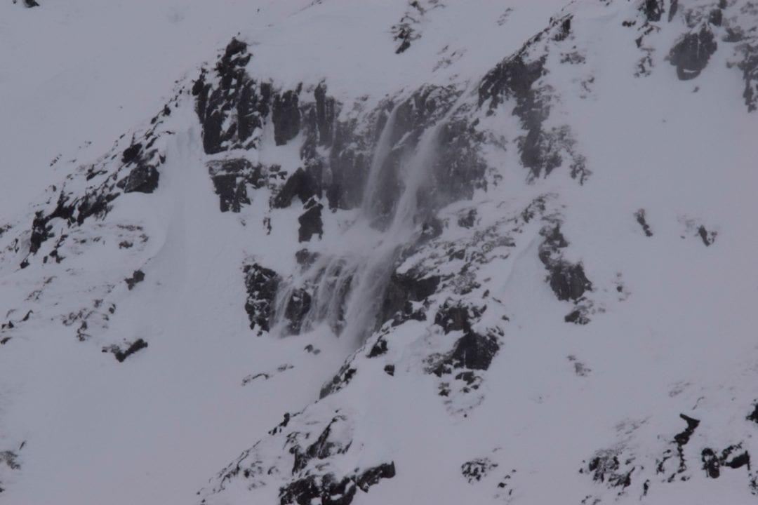
Above: constant dry loose avalanching/spindrift off of Skyscraper.

Above: Natural small (D1) wind slab on E aspect of Fishhook Creek sidewall.
You can see observations related to these avalanches here.
Weather
Weather History
13″ of new light density snow (1.03″ SWE) has fallen since the morning of Saturday 12/29, and much of this snow has been accompanied by strong SE winds. Nearly 2″ of snow (0.1″ SWE) fell Saturday 12/29, 0.14″ SWE fell during strong winds Sunday 12/30, 1.5″ of snow (4 cm SWE) fell Monday 12/31, and 10″ of snow (0.61″ SWE) fell Wednesday 1/2.
Wind speeds were 20-40 mph, gusting 30-50 mph at ridgetops Sunday 12/30-Tuesday 1/1. Valley bottoms winds increased from to 10-18 mph Sunday 12/30 – Tuesday 1/1. Ridgetop winds decreased to 5-10 mph with gusts up to 20 mph with the latest round of snowfall Wednesday 1/2.
Temperatures on ridgetops increased from single digits F Saturday 12/29 into the 20s F and low 30s F this week. In valley bottoms temperatures increased from teens F Saturday 12/29 to lower 30s F during the week.
Forecast Weather
Thursday there is a chance of isolated snow showers in the morning with trace accumulation. Winds are expected to be calm to light (up to 10 mph) at ridgetops out of the NE. Skies are forecast to be sunny Thursday and mostly sunny Friday. Temperatures are expected to be colder, with highs in the low teens and lows in the single digits.
Stay tuned to the NOAA point forecast for an updated weather forecast each day. The best way to see if it’s snowing in Hatcher Pass is to look at the webcam snow stake HERE and the Independence Mine SNOTEL site HERE
Announcements
This information is a Conditions Update. This is not an Avalanche Advisory. The next avalanche advisory is scheduled for Saturday January 5, 2019.
Previous avalanche advisories HERE
TODAY’S BOTTOM LINE: A series of strong storms brought 17″ of snow, strong SE ridge top winds, and moderate valley bottom winds since Friday 12/27. Another round of dangerous avalanche conditions is expected, as our thin, weak snowpack has been overloaded once again. Careful snowpack evaluation, cautious route-finding, and conservative decision making will be essential if you venture into the mountains of Hatcher Pass today. Natural avalanches are possible and human-triggered avalanches are likely at upper elevations (>3000 ft) on wind-loaded slopes.
Click on the “FULL FORECAST“ button for all the details, below.