Detailed Observation
| Date | 2022-02-10 |
| Location | Eastern Alaska Range |
| Observer | James D Smith |
| Avalanche | N |
General Observations
While in the area, dug a quick pit near McCallum Creek Road to see how things looked in this zone. Found about 1 – 1.5 meters of snow generally and mostly soft powder and depth hoar (i.e. you will be waist deep off your skis or sled, at least down at road level).
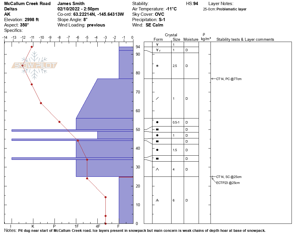
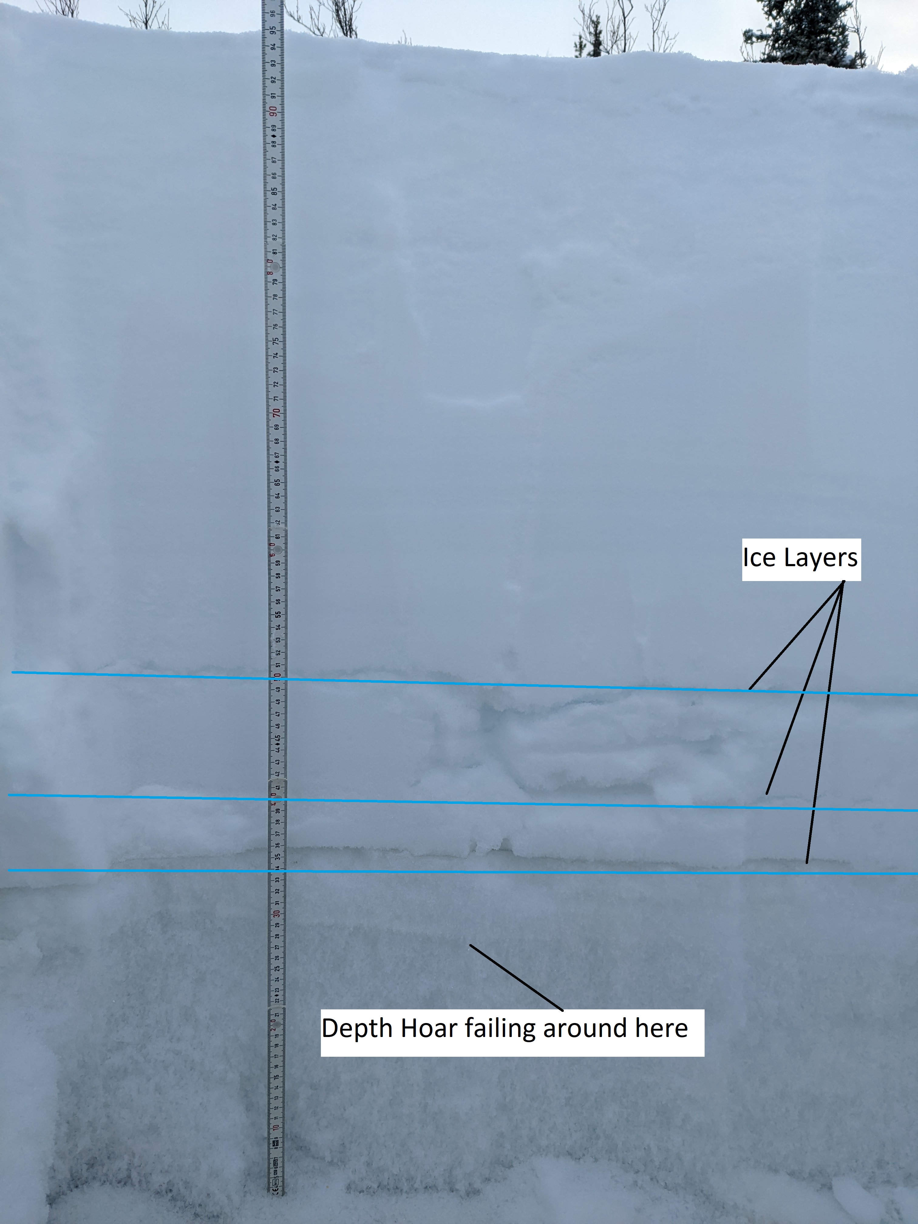
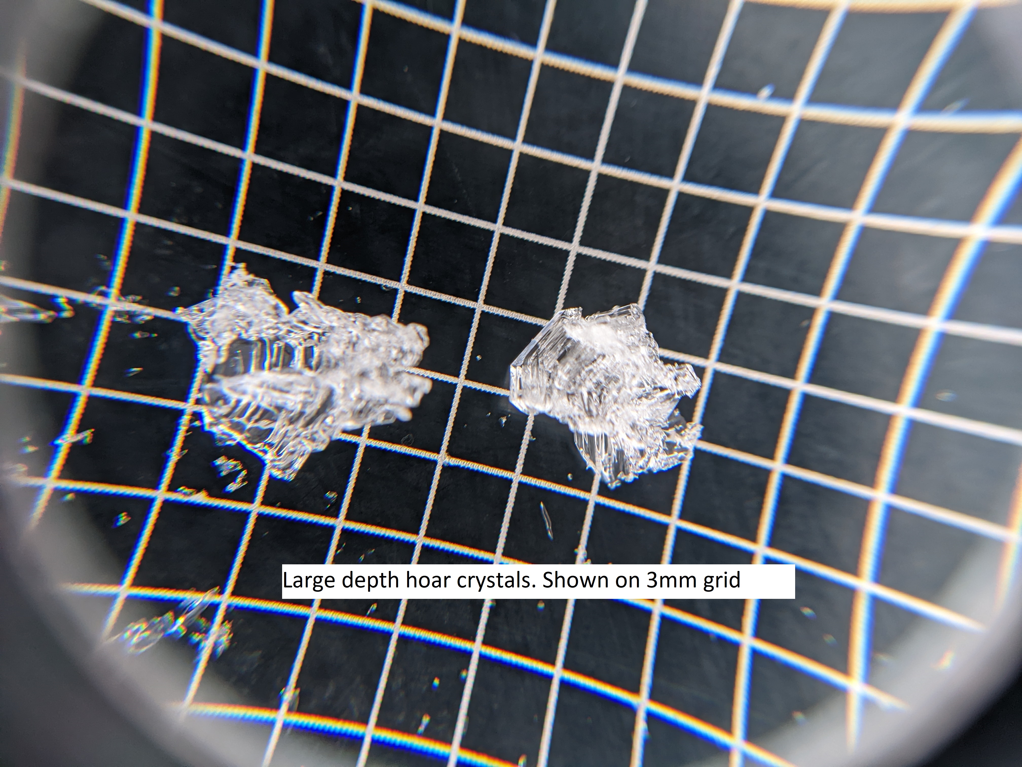
Pit dig at road level (about 3000ft) in an open area with 94cm total snow depth. Found 3 different ice layers here, more spread out than the ice layers noted from Devils Thumb on the same day. However, the main difference here is the ~35cm of large depth hoar crystals that make up the bottom of the snowpack. Snowpack tests indicate that there is significant weakness here with CT14 SC and ECTP23, both in this depth hoar layer. Full pit details in attached image.
While purely a guess, I would assume that this weak depth hoar layer is responsible for the widespread slides that Clyde noted on 01/30/2022 near Gunn Creek. His images show slides that appear to run at or very close to ground level and the two areas experience similar local weather. I agree with Clyde’s assessment that the snow in this area is touchy. Travel with caution as depth hoar problems tend to be persistent for a long time in our snowpack.
Uploaded Images