Valdez
Above 3,000ftModerate
1,500 to 3,000ftModerate
Below 1,500ftModerate
Degrees of Avalanche Danger
Avalanche Problems
Problem 1
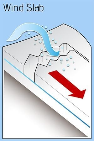
Identifying where wind slabs exist, their sensitivity and depth should be the main focus for safe travel in the mountains today. On 1/7. winds were moderate through wind channelled terrain such as Thompson Pass and calm further from ridge lines gaps and passes. The affect from yesterday will be an increase in depth and stiffness of wind slabs in the area directly surrounding Thompson Pass. It will be possible to trigger an avalanche 1-2 feet in depth in specific areas. These places include the lee side of high elevation ridge lines, cross loaded gullies and lee side of terrain features.
Light snowfall and light-calm winds are forecasted over the next 24 hours which will mask visual signs of previous wind distribution. Pay attention to what slopes previous NE winds (direction could be different depending upon terrain influence) have loaded, and use test slopes to gauge sensitivity and depth.
Watch for signs of instability such as shooting cracks and slopes being actively loaded by wind.
Wind slabs are expected to gain strength with benign weather forecasted over the next 48 hours. The hazard will be lower in areas unaffected by wind.
Likelihood:
- Almost Certain
- Very Likely
- Likely
- Possible
- Unlikely
Size:
- Historic
- Very Large
- Large
- Small
Trend
- Increasing
- Steady
- Decreasing
Problem 2
Faceted snow in the bottom portion of our snowpack continues to exist in all three climate zones. Human triggered or natural avalanches have not been reported or observed at this layer since 12/16. At this point, it is unlikely for a person to trigger an avalanche at this layer . Although, trigger points may still exist in isolated locations like thin rocky areas where the overlying slab is thinner and a person or machine could affect weak facets near the ground.
In most locations above brush line very hard wind damaged snow is overlying persistent weak layers. This has effectively created a bridging affect and is one reason why affecting these layers, is not currently likely. Remember that unlikely does not mean impossible. Realize that this flaw in our snowpack exists and keep that information in mind while making terrain decisions in the future. Triggering an avalanche at this layer would have severe consequences.
The most likely areas to trigger a persistent slab avalanche will be in the Continental zone where a more faceted snowpack is in place and previous wind events were less severe. Below brush line is also a concern as alders provided shelter from winds allowing persistent grains to survive near the surface as well as colder temps that would promote facets during inversions.
Likelihood:
- Almost Certain
- Very Likely
- Likely
- Possible
- Unlikely
Size:
- Historic
- Very Large
- Large
- Small
Trend
- Increasing
- Steady
- Decreasing
Avalanche Activity
Below is a summary of observed Avalanche activity from the last 7 days. Avalanches that were noted earlier in the season can be viewed by clicking the link below.
If you trigger or observe a natural avalanche consider leaving a public observation.
1/3- Several small/medium D1.5-2 natural wind slab releases were observed on the upper elevations of Town mountain ~4000′ SW-S aspects. No step downs.
Weather
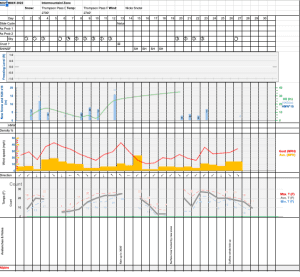
Check out our updated weather tab! A collection of local weather stations are available for viewing with graphs and tabular data included.
NWS Watches and warnings
NONE
NWS Point forecast for Thompson Pass
Date               Sunday 01/08/23         Monday 01/09/23
Time (LT)          06    12    18    00    06    12    18    00    06
Cloud Cover        OV    OV    OV    OV    SC    FW    SC    BK    OV
Cloud Cover (%)   100   100    95    75    25    20    40    50    90
Temperature         8    16    21    18    19    17    18    15    17
Max/Min Temp                   21          14          23          14
Wind Dir           NE     E     E     E    NE     E     E     E     E
Wind (mph)          9     5     3     2     3     2     1     1     5
Wind Gust (mph)
Precip Prob (%)    80    80    50    10     5     0     5     0    30
Precip Type         S     S     S                                   S
12 Hour QPF                  0.26        0.05        0.00        0.01
12 Hour Snow                  4.5         0.0         0.0         0.0
Snow Level (kft)  0.4   1.2   1.5   1.0   0.5   0.3   0.3   0.3   0.3
Click on link below for Thompson Pass weather history graph:

| Date:
01/08 |
24 hr snow | HN24W* | High temp | Low temp | 72 hour SWE* | January snowfall | Seasonal snowfall | Snowpack Depth |
| Valdez | 0 | 0 | 30 | 12 | .01 | 5 | 102 | 38 |
| Thompson pass | 0 | 0 | 6 | -7 | 0 | 33 | 227 | 43 |
| 46 mile | 0 | 0 | 7 | -10 | 0 | 20 | ~56** | 42 |
*HN24W- 24 hour Snow water equivalent in inches
*SWE– Snow water equivalent
**46 mile seasonal snowfall total begins December 1st.
Additional Information
Click on the link below for a running summary of the seasons weather history.
Announcements
The avalanche hazard is moderate at all elevations. Human triggered wind slab avalanches will be possible 1-2 feet deep in specific locations. These include lee slopes and cross loaded terrain. The area directly surrounding Thompson Pass will be the most likely place to encounter new and sensitive wind slabs.
Posted by Gareth Brown 01/08 8:00 am.
For a description of current avalanche problems, weather information, season history and more click the (+ full forecast) button. Avalanche forecasts will be issued Wednesday-Sunday.

