Valdez
Above 4,000ftConsiderable
2,000 to 4,000ftConsiderable
Below 2,000ftConsiderable
Degrees of Avalanche Danger
Avalanche Problems
Problem 1
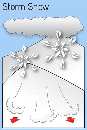
An abrupt change in weather overnight and today has elevated the avalanche hazard to considerable. Storm totals of 12-18 inches are expected by this evening that are not expected to bond well with the underlying wind affected surface.
Temperatures are expected to increase for a short time during the day pushing the freezing line to 1000′ before cooling off once again this evening. This increase in temperature will coincide with a change of wind direction from NE to SE and an increase in strength. This will create an upside down storm slab, which will result in instabilities within the storm snow as well as at the new/old interface.
We currently have all three ingredients for avalanches to occur. A bed surface, old wind affected snow. A weak layer, small facets on top of old wind slabs and a slab, which is currently accumulating. Conservative terrain choices will be necessary for safe travel in avalanche terrain today. Shooting cracks, collapsing and natural avalanche activity are all signs that unstable snow exists and human triggered avalanches will be likely on slopes steeper than 30°.
Likelihood:
- Almost Certain
- Very Likely
- Likely
- Possible
- Unlikely
Size:
- Historic
- Very Large
- Large
- Small
Trend
- Increasing
- Steady
- Decreasing
Problem 2
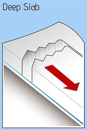
Todays storm is adding stress to weak snow at the bottom of our snowpack. It is currently unlikely for human triggered or natural avalanches to occur at this layer. This is due to the strength of old wind affected snow at this interface, and an insufficient amount of forecasted new snow to tip the scales.
Over three weeks of dry and windy weather previous to this storm has decreased the height of our snowpack and caused layers near the ground to facet (loose strength). This weak snow will potentially become an issue later in the season depending on the amount of new snow we receive in the future. Stay tuned!
Likelihood:
- Almost Certain
- Very Likely
- Likely
- Possible
- Unlikely
Size:
- Historic
- Very Large
- Large
- Small
Trend
- Increasing
- Steady
- Decreasing
Avalanche Activity
Below is a summary of observed Avalanche activity from the last 7 days. Avalanches that were noted earlier in the season can be viewed by clicking the link below.
If you trigger or observe an avalanche consider leaving a public observation.
No natural or human triggered avalanches have been reported or observed the last 7 days. Last activity observed occurred on the 7th and 8th during a strong temperature inversion that brought above freezing temperatures to mid and upper elevations for an extended period. Strong north winds on 3/9-10 may have produced some small avalanches, although none have been reported or observed.
Weather
Check out our updated weather tab! A collection of local weather stations are available for viewing with graphs and tabular data included.
NWS Watches, warnings and advisories
Northeast Prince William Sound-
Including the cities of Valdez and Thompson Pass
702 AM AKDT Fri Mar 17 2023

...WINTER WEATHER ADVISORY REMAINS IN EFFECT UNTIL NOON AKDT
TODAY...

* WHAT...Snow and blowing snow expected. Total snow
  accumulations of 4 to 8 inches. Winds gusting as high as 35
  mph reducing visibility to one half mile at times in blowing
  snow.

* WHERE...Thompson Pass.

* WHEN...Until noon AKDT Friday.

* IMPACTS...Plan on slippery road conditions. Areas of blowing
  snow could significantly reduce visibility.

* ADDITIONAL DETAILS...Snow and gusty northeast winds will
  contribute to blowing snow and reduced visibility across
  Thompson Pass through the morning hours. Winds are expected to
  become southeasterly by midday today with warming temperatures
  to diminish the overall threat for blowing snow. Snow showers,
  however, are expected to continue into Friday night.
NWS Point forecast for Thompson Pass
Date               Friday 03/17/23         Saturday 03/18/23
Time (LT)          06    12    18    00    06    12    18    00    06
Cloud Cover        OV    OV    OV    OV    OV    OV    OV    OV    OV
Cloud Cover (%)   100   100   100    85    70    85    90    75    85
Temperature        17    27    30    27    23    25    26    21    19
Max/Min Temp                   30          22          27          19
Wind Dir           NE     E     E    SE     E    NE    NE    NE    SE
Wind (mph)         20    23    27    11     8    11    17    11    16
Wind Gust (mph)    34                23
Precip Prob (%)   100    90    90    70    50    30    40    30    80
Precip Type         S     S     S     S     S     S     S     S     S
12 Hour QPF                  0.50        0.13        0.14        0.14
12 Hour Snow                  6.9         1.1         0.0         1.3
Snow Level (kft)  0.1   1.3   1.0   0.3   0.2   0.2   0.2   0.5   0.2
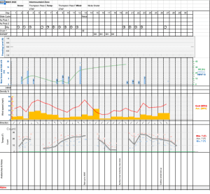
Click on link below for Thompson Pass weather history graph:

| Date:
03/17 |
24 hr snow | HN24W* | High temp | Low temp | 72 hour SWE* | March snowfall | Seasonal snowfall | Snowpack Depth |
| Valdez | 8 | .4 | 32 | 17 | .4 | 10 | 228 | 54 |
| Thompson Pass | ~8 | N/O | 18 | 9 | N/O | 15 | 383 | N/O |
| 46 mile | ~8 | N/O | 21 | 2 | N/O | 12 | ~94** | N/O |
*HN24W- 24 hour Snow water equivalent in inches
*SWE– Snow water equivalent
**46 mile seasonal snowfall total begins December 1st.
Additional Information
Click on the link below for a running summary of the seasons weather history.
Announcements
The avalanche hazard is CONSIDERABLE at all elevations. Heavy new snowfall is accumulating in all three of our forecast zones with 6-8 inches overnight and an additional 6-10 expected during the day. Initially, this new snow is not expected to bond well. Human triggered avalanches are likely up to one foot in depth and natural avalanches are possible. Conservative terrain choices will be essential for safe travel in avalanche terrain today. The hazard will move to HIGH if we receive more than 2 feet of new snow.
Posted by Gareth Brown 03/17 8:00 am.
For a description of current avalanche problems, weather information, season history and more click the (+ full forecast) button. Avalanche forecasts will be issued Wednesday-Sunday.
If you have pictures of recent natural or human triggered avalanches or notice signs of instability such as shooting cracks or collapsing, leave an observation to help improve forecast accuracy.

