Valdez
Above 3,000ftConsiderable
1,500 to 3,000ftConsiderable
Below 1,500ftLow
Degrees of Avalanche Danger
Avalanche Problems
Problem 1
Likelihood:
- Almost Certain
- Very Likely
- Likely
- Possible
- Unlikely
Size:
- Historic
- Very Large
- Large
- Small
Trend
- Increasing
- Steady
- Decreasing
Problem 2
Likelihood:
- Almost Certain
- Very Likely
- Likely
- Possible
- Unlikely
Size:
- Historic
- Very Large
- Large
- Small
Trend
- Increasing
- Steady
- Decreasing
Avalanche Activity
Weather has prevented the ability to observe recent natural avalanches.
Weather
Snowfall is forecast to increase tonight with snowline expected to rise to 1500′ overnight. There is .7″ of water forecast for Thompson Pass which could add up to 4-8″ of new snow overnight. Winds will be moderate to strong from the SE. Temperatures are forecasted to rise over the next couple of days.
Additional Information
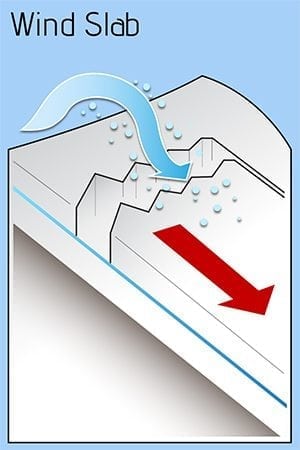
There is 8-12 inches of dry snow that has been pushed into windslab 4-6 inches thick in areas that are exposed to the wind. Expect additional snowfall of 4-8″ , moderate to strong SE wind, and rising temperatures will elevate the hazard to considerable above 2000′.
Windslab avalanches are the most likely problem tomorrow. Watch out for cross loaded terrain. If you experience areas that are stripped by the wind. Expect that the other side of the ridge will hold windslab that will likely be reactive on slopes over 32°.
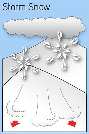
In areas that are protected from the wind there is the potential for Storm Snow avalanches. Especially if we receive more snow than forecasted and/or temps warm up more than forecasted.
Avoid Crossloaded gullies, avalanche paths, and terrain traps tomorrow. Careful decision making and route finding will be necessary.
Forecast Confidence is low.
Alerts
The avalanche hazard will increase to Considerable overnight for mid and upper elevations. An additional 4-8 inches of snowfall along with strong winds and rising temperatures will make human triggered avalanches likely on slopes over 32°. Avoid wind loaded slopes, avalanche paths and terrain traps.
Announcements
Thanks to everyone that came last night to the Fat Mermaid to support your local avalanche center!


