Valdez
Above 4,000ftModerate
2,000 to 4,000ftModerate
Below 2,000ftLow
Degrees of Avalanche Danger
Avalanche Problems
Problem 1

Likelihood:
- Almost Certain
- Very Likely
- Likely
- Possible
- Unlikely
Size:
- Historic
- Very Large
- Large
- Small
Trend
- Increasing
- Steady
- Decreasing
Problem 2
Likelihood:
- Almost Certain
- Very Likely
- Likely
- Possible
- Unlikely
Size:
- Historic
- Very Large
- Large
- Small
Trend
- Increasing
- Steady
- Decreasing
Avalanche Activity
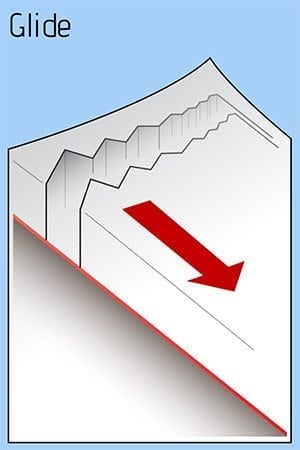
12/18- A large glide release was reported off Snowslide Gulch middle peak size 2.5.
12/15- Observed small natural avalanche on west aspect of Goodwills. Released below a cliff band at the bottom of a slope, 100′ wide. SS-N-D1-N
12/8- An observer witnessed a glide crack avalanche. SW aspect of peak 4690′ above the Valdez Glacier Lake. The debris reportedly ran all the way to the lake, with the deposition pile only feet away from a well used cross country ski trail.
Weather
12/23- Snow is forecasted for our region today with .75 inches of water expected over the next 24 hours. This could produce 6-12 inches of new snow by tomorrow morning.
The Thompson Pass Mountain Forecast covers the mountains (above
1000 ft) surrounding Keystone Canyon through Thompson Pass to
Worthington Glacier.

This forecast is for use in snow safety activities and emergency
management.

                   Today        Tonight

Temp at 1000`      27 F         24 F

Temp at 3000`      19-28 F      28 F

Chance of precip   90%          70%

Precip amount
(above 1000 FT)    0.30 in      0.37 in

Snow amount
(above 1000 FT)    3-5 in       4-7 in

Snow level         400 ft       sea level

Wind 3000` ridges  S 3-13 mph   E 2-13 mph
| 24h snowfall (inches) | HN24W (inches)* | Hi Temp (F) | Low Temp (F) | Dec snowfall | Season Snowfall | |
| Valdez | 4 | .2 | 23 | 14 | 11 | 35 |
| 46 mile | 2 | .2 | 2 | -4 | – | – |
|
Nicks snotel (4500′) |
3 | – | 18 | 8 | – | – |
HN24W= total water received last 24 hours in inches
Additional Information
Outflow winds died down on 12/22 and were replaced by light snowfall. The snow surface consists of a mix of very dense wind slab and snow stripped down to the 12/9 rain crust. Wind slab showed signs of gaining strength by being stubborn to triggers on test slopes. Human triggered avalanches are still possible, avoid large avalanche paths . Watch for collapsing and shooting cracks in the snowpack, these are indicators that wind slab still has the energy to avalanche.
New snow may have difficulty bonding to the current surface initially. If we receive more snow than forecasted expect new snow instabilities.
On 12/20, found reactive wind slab on test slopes in the Mt. Dimond area. Wind slab was 6-18 inches deep and failed at the 12/9 rain crust. There is a lot of spatial variability with the 12/9 rain crust, as in some places it reaches only up to 3000′ and in others it is found up to 4500′. In this location, the rain crust was faceting and losing strength. Above 4000′, where there is no rain crust, there is more available snow for transport which means deeper wind slab.
The further north you go from Thompson Pass, expect thinner snowpacks. Triggering an avalanche on a persistent weak layer will be more likely in the continental zone.
If you have traveled in the mountains, please leave a public observation. The more info we can get from various locations will help us to get a clearer picture of the snowpack in our beautiful Valdez Chugach!
Forecast Confidence is Moderate.
Video taken 12/20 in the Mt. Dimond area showing reactive test slopes. https://vimeo.com/user106668057/review/380916811/02da5d1cc7
Announcements
The avalanche hazard is Moderate at mid and upper elevations. Human triggered avalanches are still possible on wind loaded terrain that is steeper than 30°. Good indicators for windslab are a rapid increase in depth of the new snow over a short distance, and a hollow, drum-like feel. Shooting cracks and collapsing will indicate unstable snow. Use caution in the mountains today, avoid large avalanche paths and terrain traps.