Hatcher Pass
Above 3,500ft None
2,500 to 3,500ft None
Below 2,500ftNone
Degrees of Avalanche Danger
Avalanche Activity
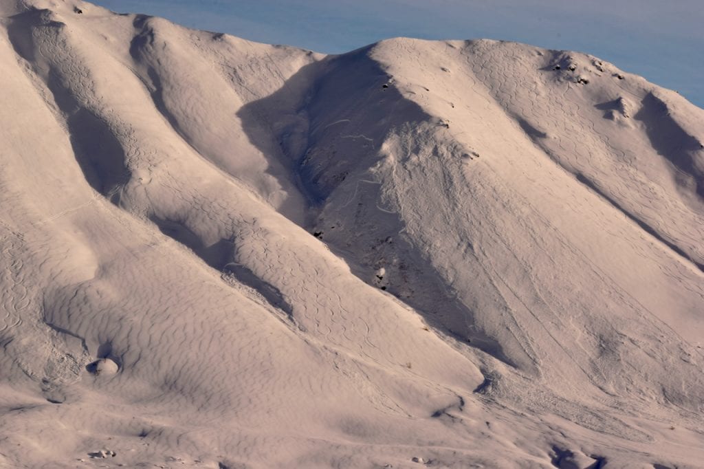
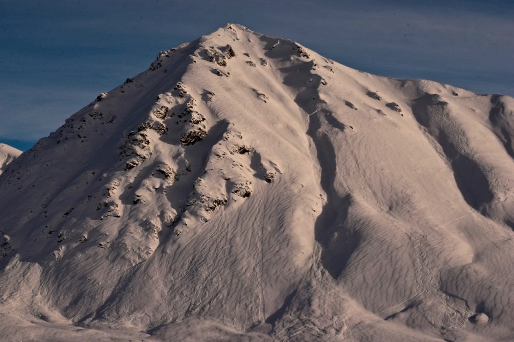
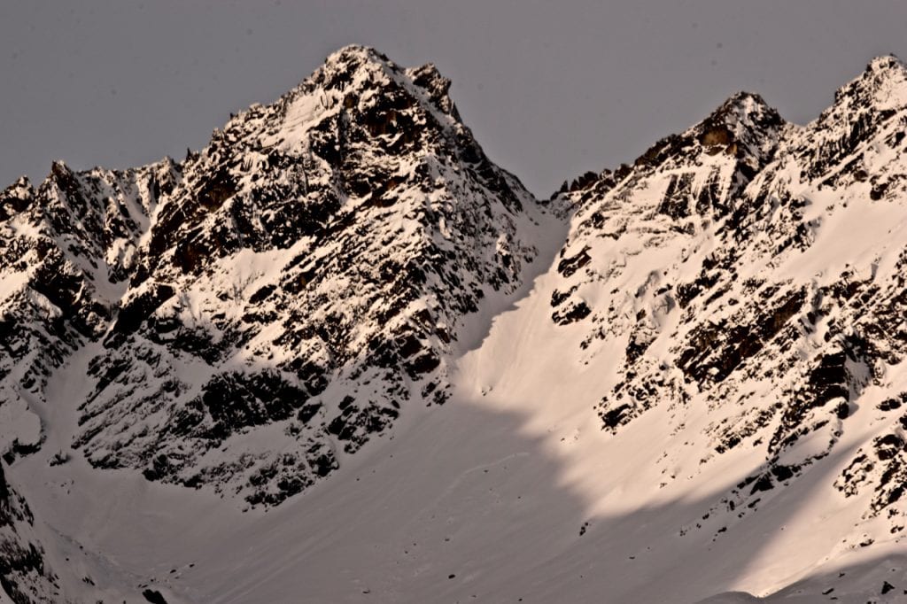
Large natural avalanche on Marmot northwest aspect, 3700′, likely 2/4-2/5. 1-3′ deep, failed in old faceted snow under old wind deposited hard slab.
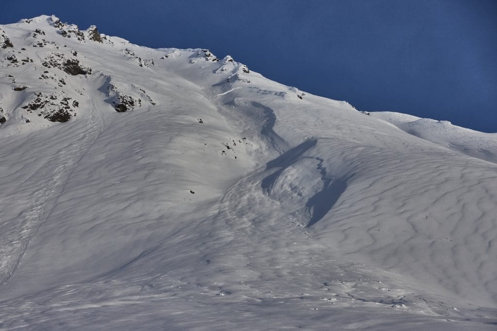
Close up view of large natural avalanche on Marmot showing the deeper persistent slab and shallower storm slab problems (easiest to identify in the foreground).
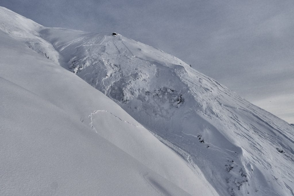
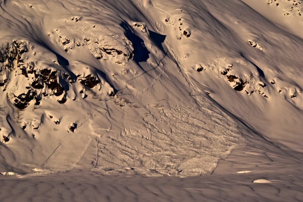
Another view of large natural avalanche on Marmot showing the deeper persistent avalanche in the death gully (left), and the separate and shallower avalanche on the nose feature (right). The avalanche on the right appears to have occurred after the one on the left, identifiable in the overlapping debris, see next picture.

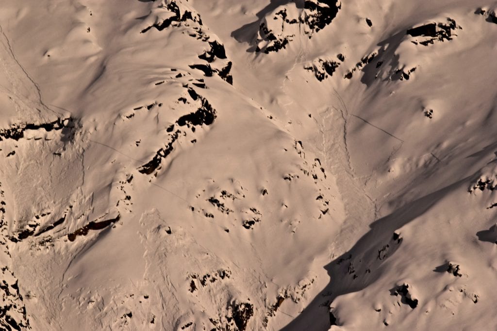
Run out of two large natural avalanches on Marmot, showing two debris piles, one from the natural avalanche in the “death gully” and the other from a shallower, natural avalanche on the nose.
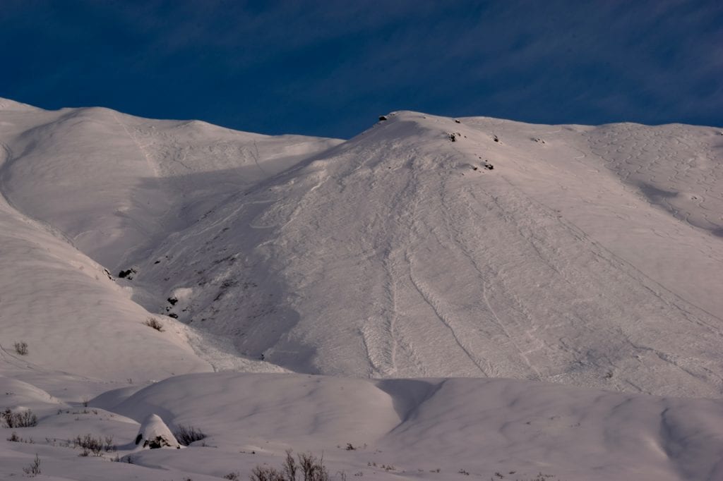
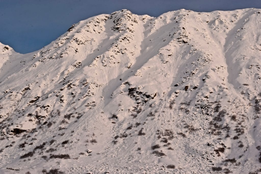
2/4 -2/5 Natural storm slab that failed on buried surface hoar. Marmot southwest aspect , 3800′.
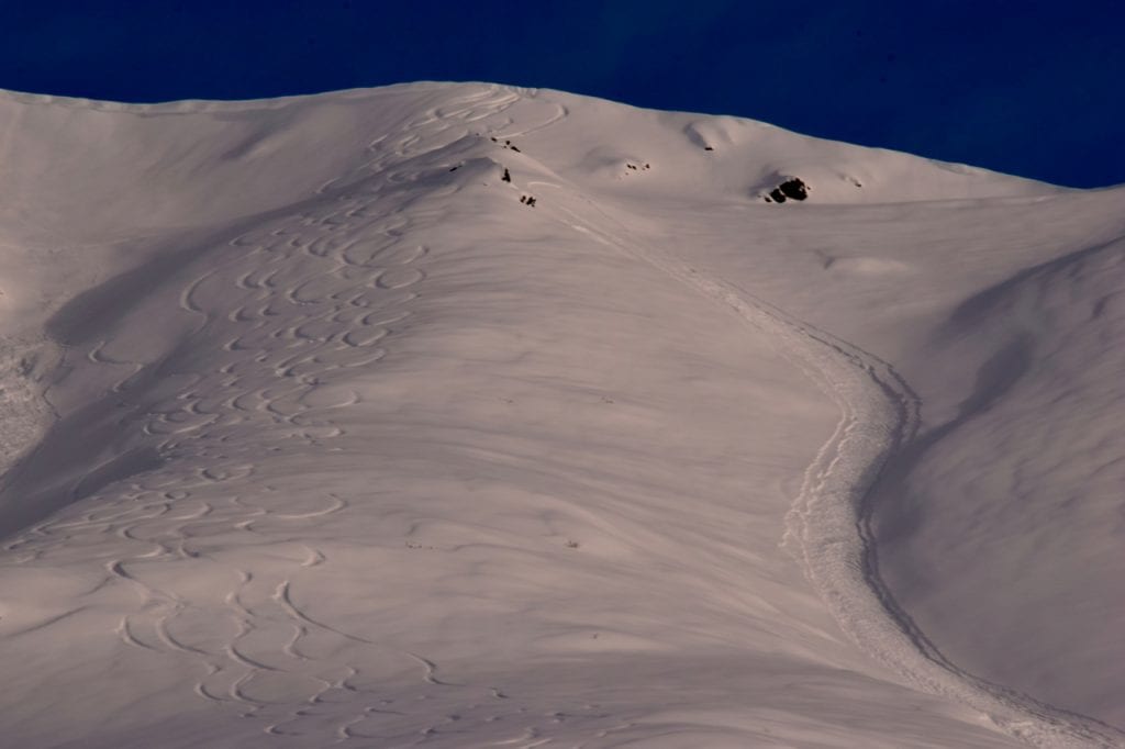
Human triggered large slab avalanche that resulted in partial burial on 2/4.
Another view of the 2/4 human triggered avalanche on Marmot.

Natural storm slab avalanche on Marmot west aspect that likely happened 2/4.

Storm slab and persistent slab avalanche in Eldorado Bowl, northeast aspect, 4100′. Likely happened 2/4-2/5.

Natural slab avalanche in Ray Wallace Chutes that likely ran 2/4.

Shallow, natural storm slab avalanches failing on BSH on Marmot west aspect that likely happened 2/5.
Storm slab avalanche below Martin Mine, east aspect, 3400′. Likely occurred 2/4.

Natural dry loose and storm slab avalanches in Delia Creek area, north and northwest aspects, 4200′. Likely occurred 2/4.
Storm slab avalanches near The Monolith. North aspect, ~4500′.
Natural storm slab avalanche up Fairangel Creek. South aspect, 4200′.

Natural dry loose and storm slab avalanches near Goodhope Creek. West-southwest aspect, 3500′.

Natural storm slab avalanche near Webfoot Prospect. Northeast aspect, 3500′.
Numerous dry loose avalanches near Goodhope Creek on Idaho Peak. West-southwest aspect, 3500′.
Weather
Weather History
Weather at 3450′ since Saturday 2/2:
Temperatures averaged 22°F, with a low of 12°F and a high of 27°F.
There has been 16.25″ of snow (1.74″ SWE) recorded at Independence Mine since Saturday 2/2.
Weather at 4500′ since Saturday 2/2:
Temperatures averaged 18°F, with a low of 10°F and a high of 24°F.
Winds averaged SSE 5 mph, max 14 mph. Gusts averaged SSE 8 mph, max gust 21 mph.
Forecast Weather
Stay tuned to the NOAA point forecast for an updated weather forecast each day. The best way to see if it’s snowing in Hatcher Pass is to look at the webcam snow stake HERE and the Independence Mine SNOTEL site HERE
State Parks Snow Report and Motorized Access information can be found here.
Announcements
This information is a Conditions Update. Danger ratings are only issued with avalanches advisories. The next avalanche advisory is scheduled for Saturday February 9, 2019.
TODAY’S BOTTOM LINE:
Avalanche hazard exists for persistent slab and loose dry avalanches at mid and upper elevations. Human triggered avalanches are possible and natural avalanches are unlikely. Remotely triggered avalanches will be possible in isolated areas.
Slab avalanches are the main concern, up to 1-3 feet deep, and large enough to bury, injure, or kill a person.
At low elevations, natural and human triggered avalanches are unlikely.
Avoid steep slopes with terrain traps such as gullies, cliffs, choose slopes with gentle, fanning runouts.
Click on the “FULL FORECAST” button for all the details, below.