Haines Avalanche Center
Above 2,500ftHigh
1,500 to 2,500ftHigh
Below 1,500ftHigh
Degrees of Avalanche Danger
Avalanche Problems
Problem 1
 Confidence: High. Distribution: Widespread on solar aspects, isolated on shaded aspects. Sensitivity: Reactive.
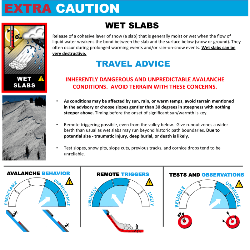
In addition to the new/old snow interface, our snowpack contains several rain/sun crusts, and a few old weak layers that will continue to weaken as the snowpack becomes warmer, softer, wetter, and weaker. All this heat and sun will cause water to percolate through the snowpack and run along crusts, which lubricates the layer. Natural and Human-caused wet slides are quite likely this weekend in terrain steeper than 30 degrees. Some of these slides will be deep and destructive.
If you travel in the mountains, do so in the early morning, before the snowpack heats up. When the snow softens to ankle-deep, it’s time to move to safer slopes. Keep an eye on the weather stations. If we do not get a solid freeze overnight, expect increased wet slide activity and high danger the next morning. Rocky areas will be common places for wet slides to be triggered.
Even small wet slides can easily entrain a person and carry them into a terrain trap.

Likelihood:
- Almost Certain
- Very Likely
- Likely
- Possible
- Unlikely
Size:
- Historic
- Very Large
- Large
- Small
Trend
- Increasing
- Steady
- Decreasing
Problem 2
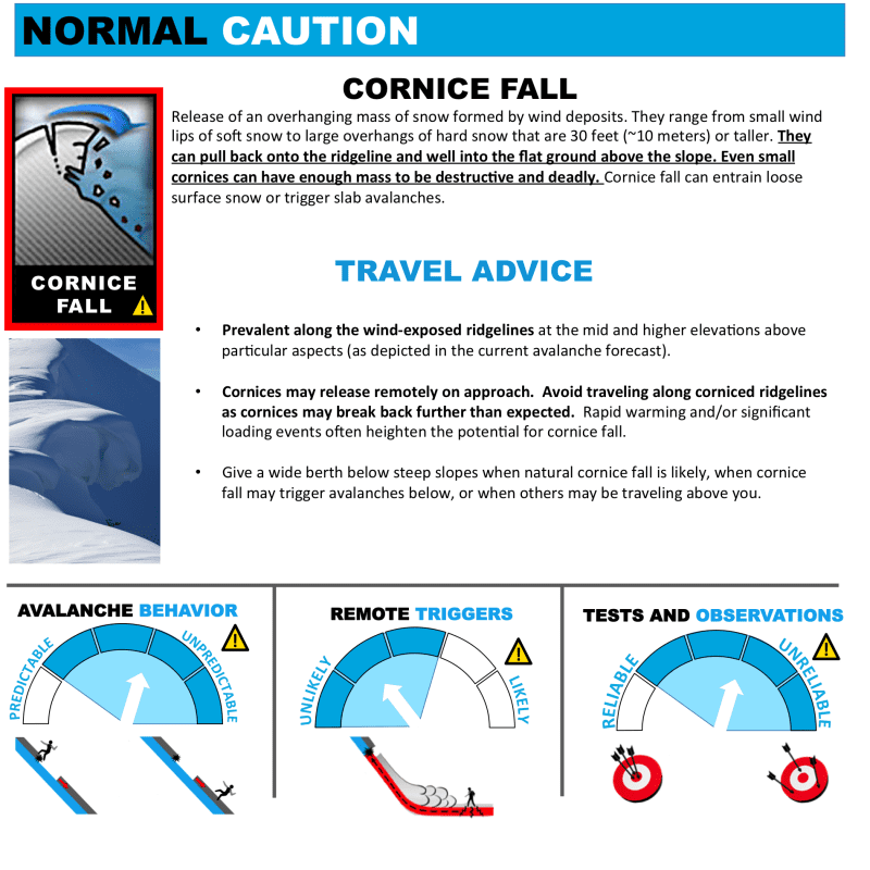
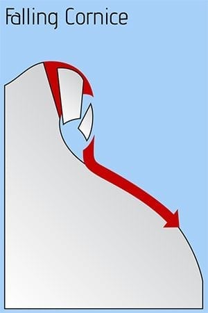
With all this sunshine, record warmth, and a whole winter’s worth of cornices built up, you should expect any snow ledges or cornices to be dangerous right now. Stay WAY back from these monsters, which are common along ridgelines and summits. Stay out from underneath any slopes that have cornices hanging overhead. They may collapse on their own at any time, or be triggered by human weight on top.
Likelihood:
- Almost Certain
- Very Likely
- Likely
- Possible
- Unlikely
Size:
- Historic
- Very Large
- Large
- Small
Trend
- Increasing
- Steady
- Decreasing
Weather
The big story this week is drastically warmer weather (record heat) that has moved into the area Thursday and will only increase through Tuesday. High temps will reach upper 50’s in the valleys, and 40’s in the mountains. Low temps in the mountains will be right around freezing. So overnight freezes look thin at best in most places. Solar radiation will be strong.
| Snow Depth [in] | Last 24-hr Snow/SWE [in] | Last 3-days Snow/SWE [in] | Today’s Freezing Level [ft] | Today’s Winds | Next 24-hr Snow/SWE | |
| Mount Ripinsky @ treeline | 130″+* | 0″ / 0.00* | 0″ / 0.00* | 0′ | mod, NW | 0″ / 0.00* |
| Flower Mountain @ treeline | 100″ | 0″ / 0.00 | 0″ / 0.00* | 0′ | mod, NW | 0″ / 0.00* |
| Chilkat Pass @ 3,100ft | 54″ | 0″ / 0.00 | 0″ / 0.00* | 0′ | mod, NW | 0″ / 0.00* |
( *star means meteorological estimate )
—The Mt. Ripinsky weather station is completely buried and no longer reporting.—
Additional Information
Practice like you play. Make sure all your rescue gear is fully functional and your beacon has full batteries. Make sure 1) everyone in the group has a functioning beacon, shovel and probe 2) knows how to use them and 3) has trained in companion rescue in the last year. Keep your skills fresh. If you head into the hills, watch out for red flag avalanche conditions, natural avalanches, whoomphing or collapsing, and shooting cracks.
Education Video Links:
- AIARE
- How to Practice Avalanche Rescue Snowmobile Edition: https://youtu.be/2ML499MMDfM
- AK Sled Shed Motorized Learning:
- Intro: https://youtu.be/aoagKHfGkxs
- Personal Electronics in Avalanche Terrain: https://youtu.be/2Vz9S0OEyFk
- Snowmobile Macgyver Tool Kit: https://youtu.be/4WBNu_t6Bbk
- Head and Face Protection: https://youtu.be/jIzW89wOyZI
- Pre-season prep: https://youtu.be/zJmrb8cZlR4
- My Transceiver: https://youtu.be/yblaDWP7Jf8
- BCA Avalanche Safety for Snowmobilers
- How to Fix Common Snowmobile Problems in the Field: https://youtu.be/g9fiTxEvuFk
- Sleducation: Avalanche Safety for Snowmobilers: https://youtu.be/EWFOd_9DYb8
- Intro to Avalanche Transceivers for Snowmobilers: https://youtu.be/6ZLSBmsceog
- Avalanche Transceiver Trailhead Test for Snowmobilers: https://youtu.be/rWoXbadFBsY
- Avalanche Transceiver Searching Use Snowmobiles: https://youtu.be/w1ucyI6LMXM
- BCA Avalanche Rescue Series
- Beacon Search 101: https://youtu.be/nnHXLVA2FcE
- Avalanche Probing 101: https://youtu.be/-0_yDN5Drzw
- Avalanche Shoveling 101: https://youtu.be/dGQg9o3vAkM
- Organizing a Backcountry Rescue: https://youtu.be/gywtmukgt8s
- Post Avalanche Patient Care: https://youtu.be/9FyIeUy4wpQ
- Backcountry Evacuation: https://youtu.be/WPF-dciefL8
- Complex Multiple Burials Backup Techniques: https://youtu.be/pB6AfY2KyYo
- National Avalanche Center
- Avalanche Problems Explained: https://youtu.be/DkbnT_9-cHU
- Intro to North American Avalanche Danger Scale: https://youtu.be/r_-KpOu7tbA
Alerts
With record warmth coming in this weekend, backcountry avalanche danger will be HIGH due to wet slabs, loose-wet, and falling cornices. Also expect to see falling ice/debris shed in steep terrain. Click the + Full Forecast link below for each zone to read more. Submit and read local observations below.