Haines Avalanche Center
Above 2,500ftConsiderable
1,500 to 2,500ftConsiderable
Below 1,500ftModerate
Degrees of Avalanche Danger
Avalanche Problems
Problem 1
The Bottom Line: Wednesday brought 6-12″ of new snow to this zone, combined with strong SE winds in the alpine. Reactive slabs of wind drifted snow in the alpine will be lurking in wind loaded areas. These slabs rest on weak storm snow and facets. Human triggering is likely on slopes steeper than 30 degrees. Wind slabs can be avoided by sticking to sheltered or wind-scoured areas. Also from the wind, cornices might be unsupported, scoured, and weak. Tread carefully around them and limit your exposure to slopes below them. A cornice drop could cause a slide, with potential for a step down.
The severe consequences of our avalanche problems remain, due to deep persistent layers. Be hypersensitive of terrain- it is an active way to manage our exposure to the risk of an unlikely but high-consequence deep slab avalanche.
When on or near avalanche terrain, be diligent on terrain selection, group management, and human factor. Travel one at a time or with enough spacing so that only one person is exposed to an avalanche path at any one time. Be prepared for an avalanche that could step down to deeper instabilities, creating a slide that could break very wide, and take out all the “safe” zones on a slope. Be extra careful not to group up in places that an avalanche can reach.

Likelihood:
- Almost Certain
- Very Likely
- Likely
- Possible
- Unlikely
Size:
- Historic
- Very Large
- Large
- Small
Trend
- Increasing
- Steady
- Decreasing
Problem 2
When seeking out wind protected zones, remember that wind-protected pockets may be harboring weak, buried surface hoar layers. Protected means preserved.
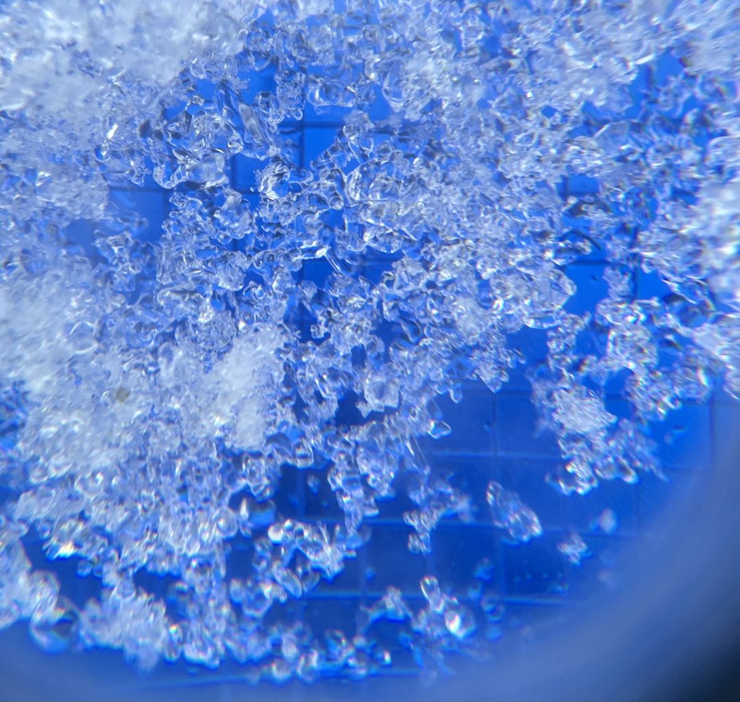
Buried Surface Hoar Layers:
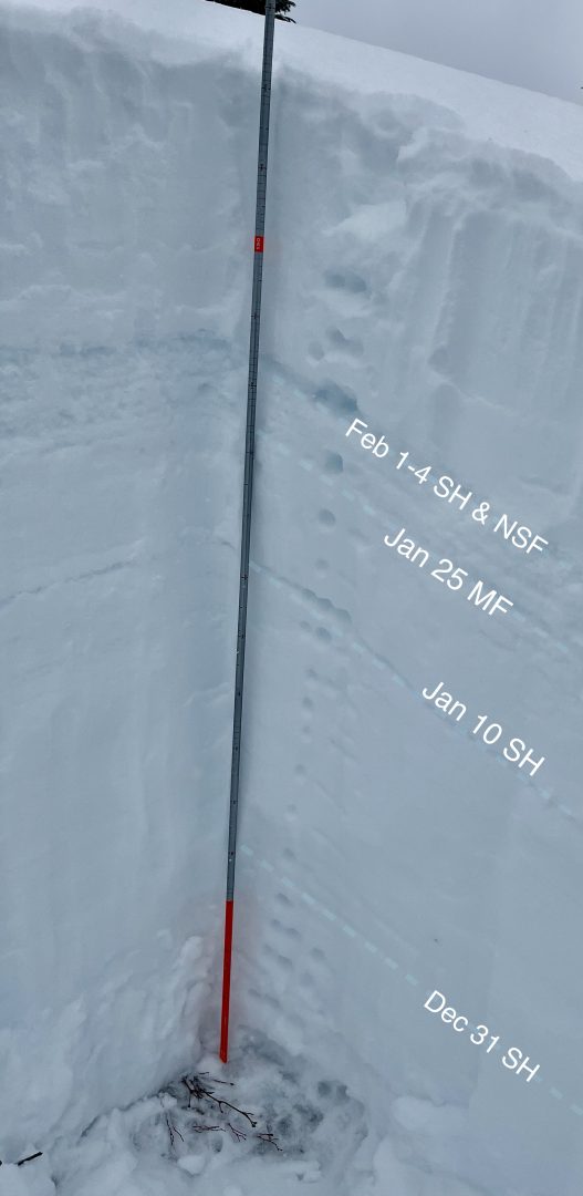
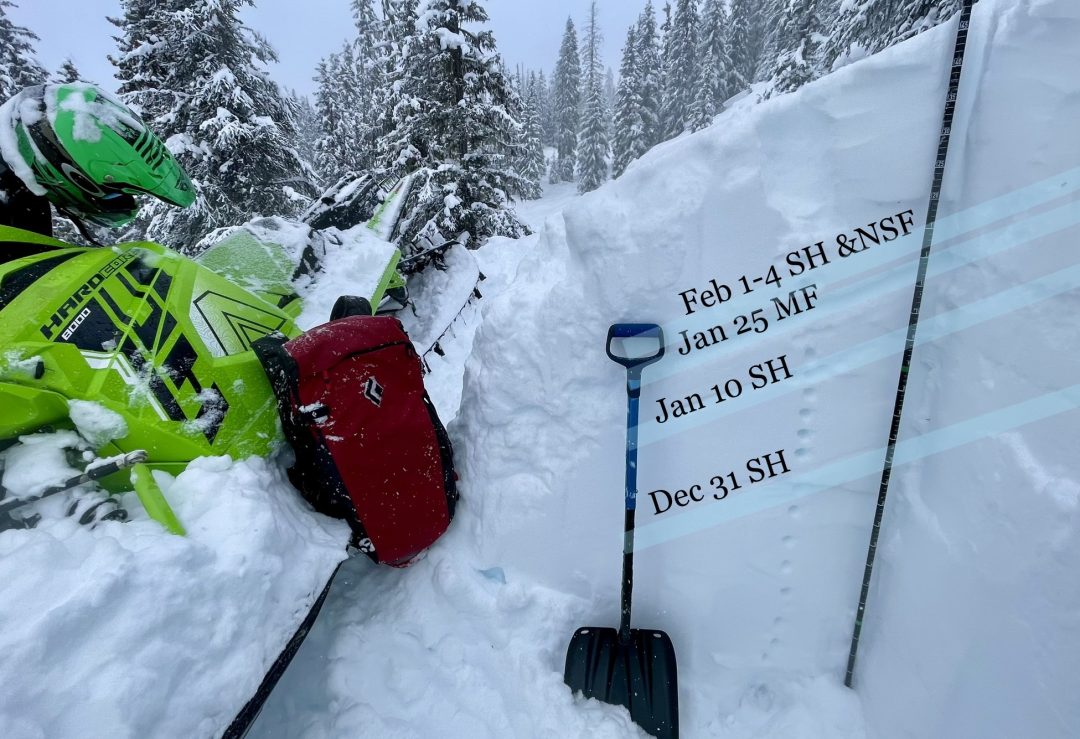
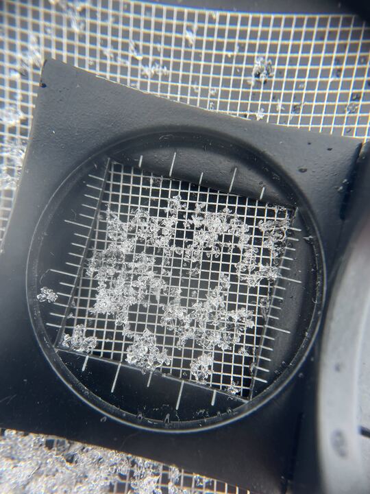
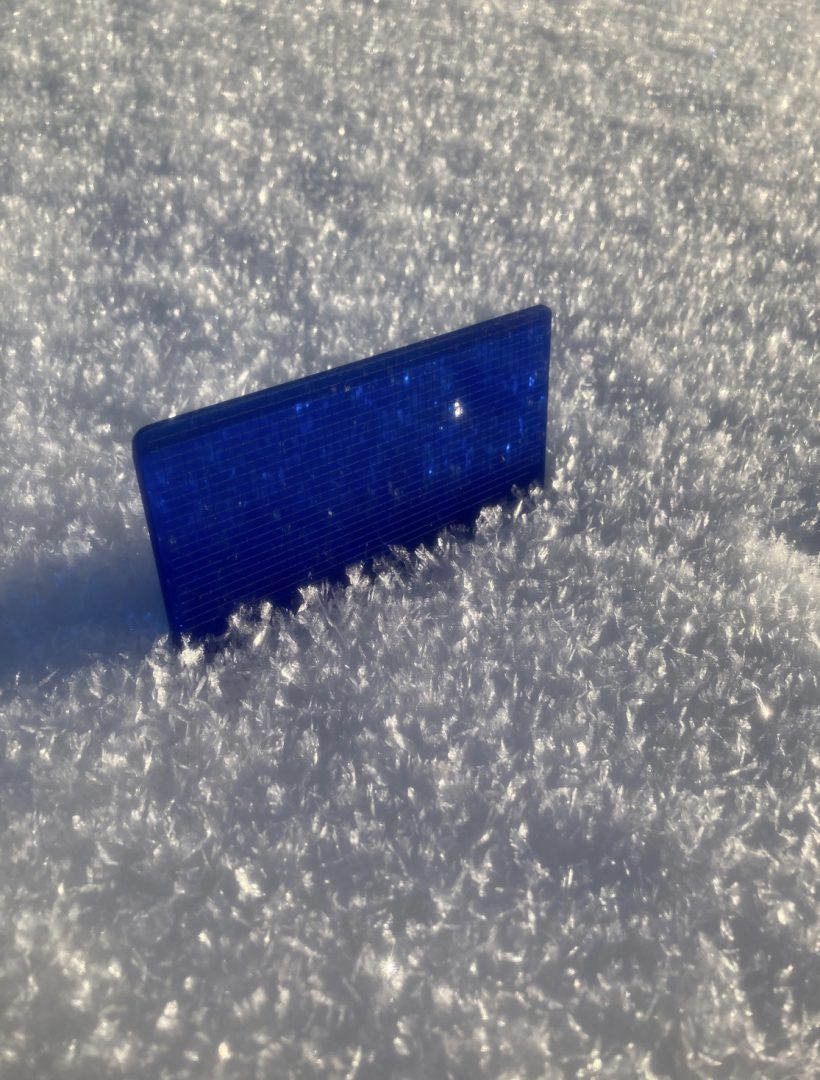
- Jan 25th melt freeze crust is 1-2′ deep (with recent winds and snow, there is a lot of variability on depth of this widespread layer) sitting on top of it are near surface facets, and buried surface hoar from Feb 1-4.
- January 10th surface hoar is now buried about 3-4 feet deep. Reports of remote-triggered activity on this layer Jan 27-28.
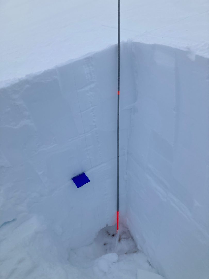
Feb 24- Haines Pass, W aspect, 2350′ Pit pictured below produced a ECTX and a PST 58/100 end down 70 cm. Photos of buried surface hoar are from the Jan 10 layer down 70cm.


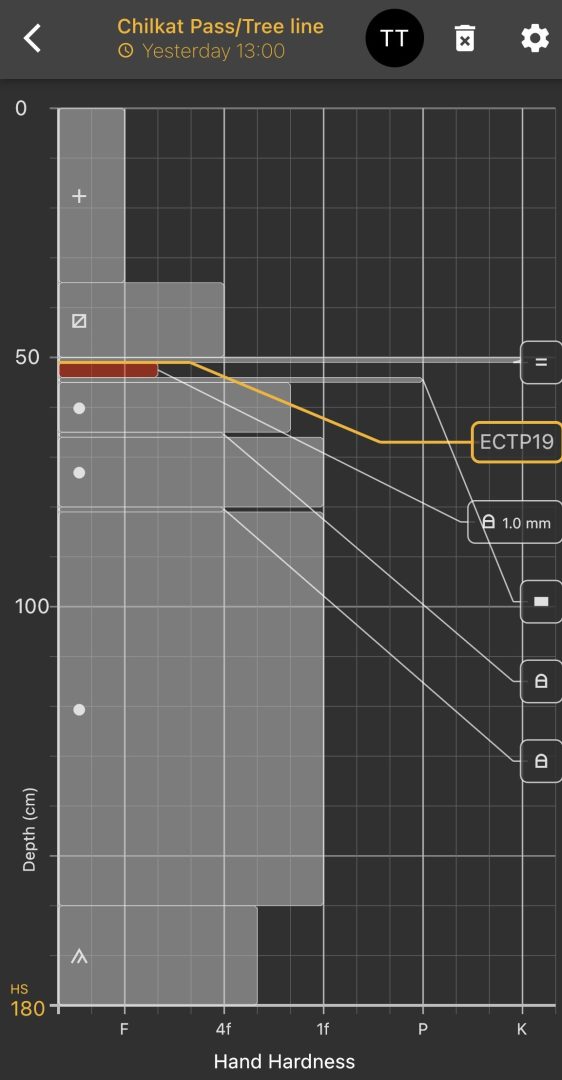
Feb 17- Haines Pass W, SW aspect. 2500′ The pit pictured below produced a ECTP19 down 40cm on facets under a thin ice lens/Jan 25 layer.
Graphed results from pit above.
Feb 17- Haines Pass tree line 2500’ S aspect ECTP24 40 cm down, below Jan 25 crust
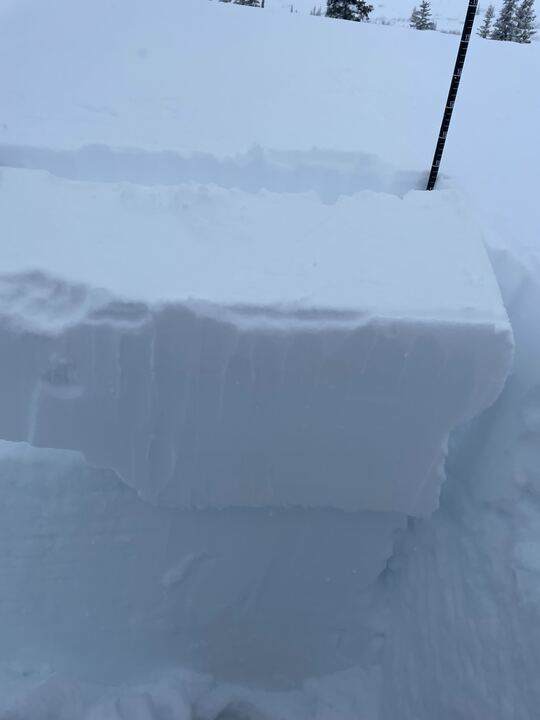
Feb 17- Haines Pass W, SW aspect. 2500′ The pit pictured below produced a ECTP19 down 35cm on Jan 25 crust/Feb 1-4 facet interface
Jan 22- Propagating result down 45 cm, 2,300′ SW-aspect, 7-Mi Haines Chilkat Pass.
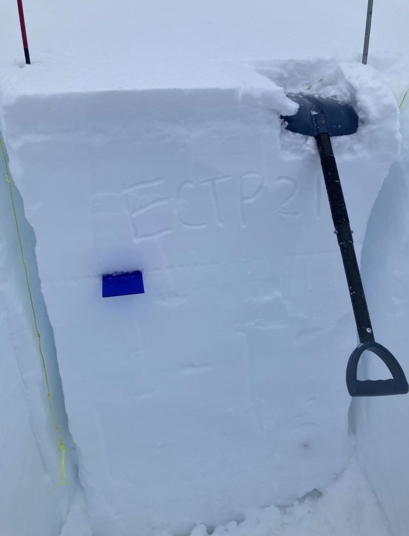
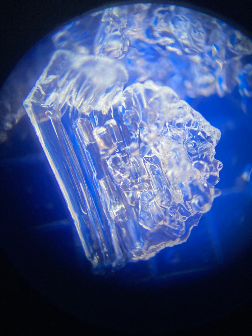
Photo taken on Jan 12 of Surface Hoar on a W aspect near treeline in the Haines Pass.

Likelihood:
- Almost Certain
- Very Likely
- Likely
- Possible
- Unlikely
Size:
- Historic
- Very Large
- Large
- Small
Trend
- Increasing
- Steady
- Decreasing
Problem 3
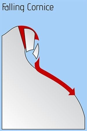
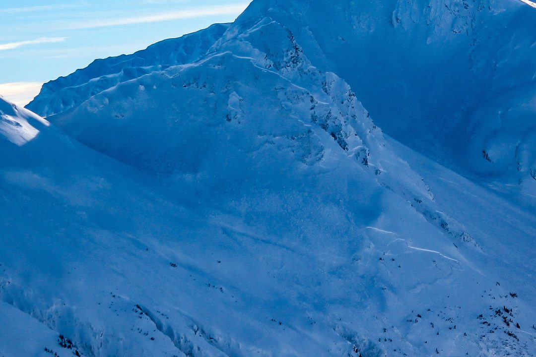
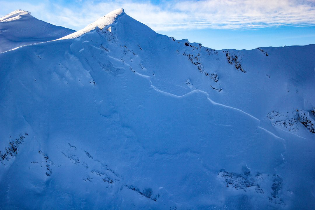
Cornices have become very large and weak. They are undercut, overhanging, and slowly sagging as they grow. Strong sunshine and increasing winds will put a lot of stress on these dangerous beasts. Stay way back from any snow ledges or cornices on ridgelines or summits. Some may fall naturally, so do not travel below them. More likely will be human triggering of cornices from above. When a cornice fails, it will break way further back on the ridge than expected and take most of the flat terrain out with it. Any cornice falls are likely to trigger very large and deadly deep-slab avalanches. Consequences are very high right now!
Likelihood:
- Almost Certain
- Very Likely
- Likely
- Possible
- Unlikely
Size:
- Historic
- Very Large
- Large
- Small
Trend
- Increasing
- Steady
- Decreasing
Problem 4
Deep weak layers under strong layers are persistent in the pass. A wide safety margin is necessary. This setup could produce avalanches that break wider than expected, and are most likely to be triggered from shallow trigger points like rocks or small trees or a smaller slide that steps down to these lower instabilities. You could ride the same slope numerous times until that right spot produces a large destructive slide.
Old Melt Layers and Crusts:
- The Dec 31 surface hoar layer is present in the Transitional and Pass zones, about 4+ft deep. This layer has been active in pits, and caused some natural avalanches in early January
- Cold temperatures and a shallow, wind scoured early season snowpack created conditions for depth hoar growth.
- A buried persistent weak layer about 6+ feet deep (The “Big Warmup” Layer, Formed Nov 17th) is still a concern. Numerous natural avalanches observed 1/27 likely on this layer.
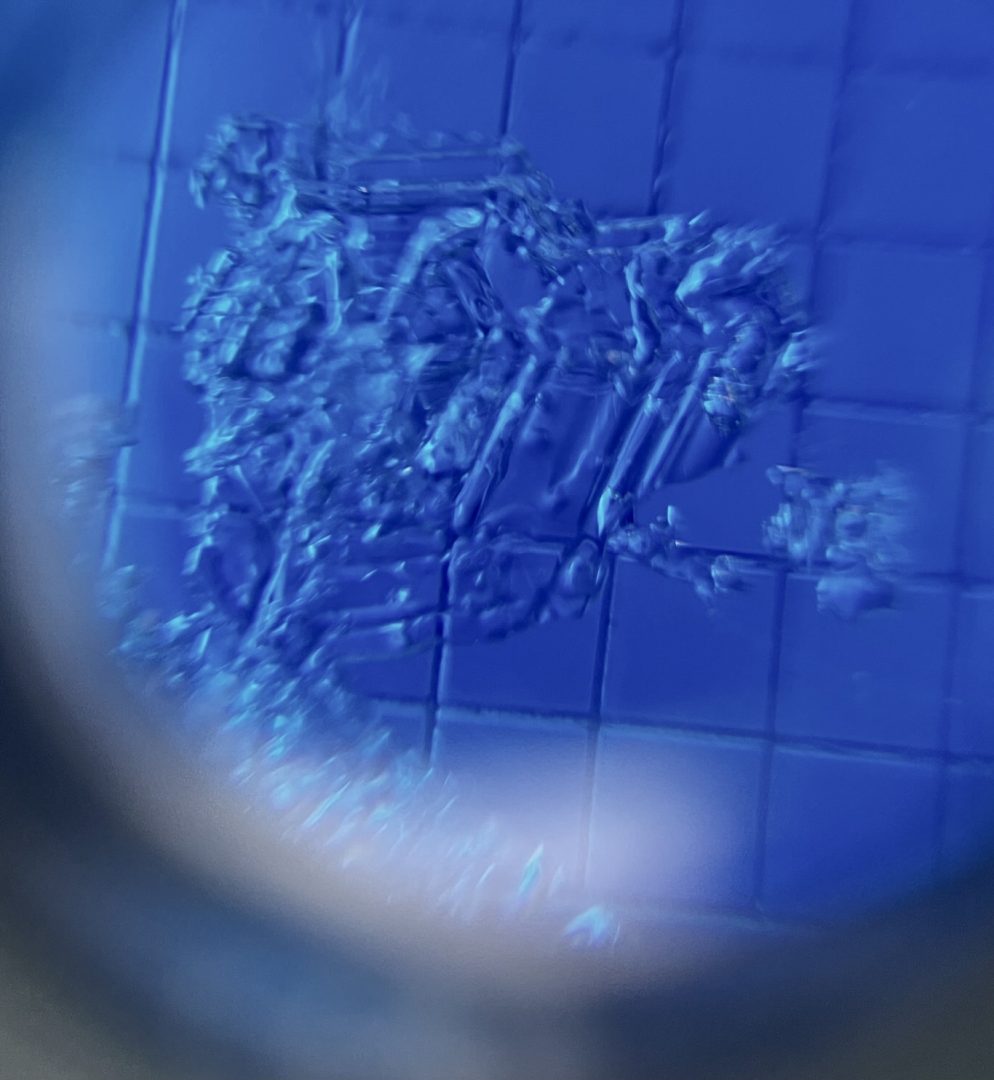
Feb 17- Haines Pass W, SW aspect. 2500′ Faceted clusters found near the ground
Photos shows 6-9mm advanced depth hoar at the ground down 180cm with ECTP 25 down 80cm on facets below a crust in the Haines Pass Zone at 4,000ft on a NE-aspect.

Likelihood:
- Almost Certain
- Very Likely
- Likely
- Possible
- Unlikely
Size:
- Historic
- Very Large
- Large
- Small
Trend
- Increasing
- Steady
- Decreasing
Avalanche Activity
March 2: Small natural soft slabs were observed in steep trees in the Lutak zone. This kind of small to large natural activity is likely widespread in the Lutak zone.
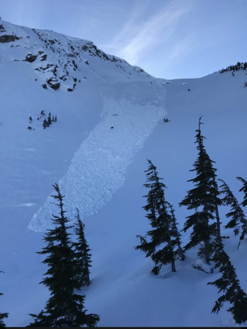
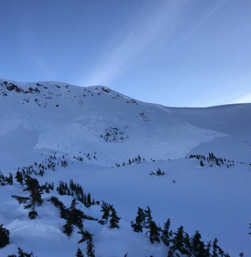
Feb 19-23: 6 different observations of natural avalanches in the transitional zone and in the Chilkat range. The natural D2 slides were on all aspects, a few on lower angle, all running on a mid-snow pack layer, and a majority with widespread propagation.
A larger, D3-R4 natural avalanche was observed near Four Winds on a S, SW aspect, down 60-120cm, it looked like a loose wet slide that maybe stepped down to a lower layer. Widespread propagation.
Feb 9: Glide cracks ~3000-3400′ in the transitional zone on N, NE aspects. Also notable was observation of reloading of bed surfaces on previous slides.
Jan 28: Lutak Zone
Glory Hole NW-aspect around 3,200′
Multiple wide propagating natural slides released during Jan 25-29th- a link to an archive of photos coming soon.
Weather
Forecast:
Friday will bring clearing skies and increasing NW winds. Those NW winds will become strong by Saturday into Sunday, with temperatures dropping into the single digits. We will be under strong high pressure for several days with no storms in sight.
Recent Weather Summary:
- March 1st brought a strong and cold storm, with 10-15″ of new snow inland, and 30″+ in the Lutak zone.
- Late Feb 20-Feb 23 a cold high pressure system with moderate to strong N, NW winds
- Feb 19-Feb 20- warmer, solar effect on south aspects, valley fog on the 19th at ~1500-2000 ft.
- Feb 12 freezing levels 1250ft
- Incremental snow (more in Lutak zone) since Feb 5th, periods of moderate S/SE winds
- Feb 1-4 Near surface facets on top of crust from Jan 25 warm-up
- Jan 17-26 brought around 5″ of precip (3-5feet of new snow above 3000ft), strong SE winds, and a noticeable warmup
- Surface Hoar and Near Surface Facet growth Jan 8-10
- A strong front brought 24-30″ of snow above 2000ft on Jan 2nd.
- There was widespread Surface Hoar growth on Dec 31st.
- Dec 23-26 brought 10-18″ of new snow and a sharp rise in temperatures from -10F to 30F along with variable winds
- Dec 16-23 brought strong NW winds and arctic cold temperatures
- Dec 15 brought warmth/light rain up to 2600ft
- Complete Season Histories: Transitional Zone Lutak Zone
| Snow Depth | Last 24-hr Snow/SWE | Last 3-days Snow/SWE | Today’s Freezing Level | Today’s Winds | Next 24-hr Snow/SWE | |
| Mount Ripinsky @ 2,500′ | ~145″ | 0″ / 0.00 | 34″ / 2.00 | 0′ | mod, NW | 0″ / 0.00″ |
| Flower Mountain @ 2,500′ | 67″ | 0″ / 0.00 | 15″ / 1.00 | 0′ | mod, NW | 0″ / 0.00″ |
| Chilkat Pass @ 3,100ft | 52″ | 0″ / 0.00 | 6″ / 0.30 | 0′ | mod, NW | 0″ / 0.00″ |
Additional Information
WEAR A HELMET! Be careful of rocks and hidden hazards. Be prepared for crevasses when on a glacier.
Are your riding companions trained and practiced in avalanche rescue? Everyone in your group needs to have a beacon, shovel, and probe, and know how to use them. Our mountains have very limited cell coverage, carry an emergency communication device and enough gear to spend the night.

Avalanche Canada’s Daily Process Flow – Utilize this everyday you go out in the mountains.
Announcements
Click the +Full Forecast link below for each zone to read more. If you see any recent natural avalanche activity, or signs of instability please submit an observation.