Hatcher Pass
Above 3,500ft Considerable
2,500 to 3,500ft Moderate
Below 2,500ftLow
Degrees of Avalanche Danger
Avalanche Activity
No new avalanche activity has been observed or reported this week.
Strong winds combined with new snow may have triggered some natural wind slab and loose dry avalanches over the last 24 hours, but no reports are available as of this morning.
Weather
This week’s weather at 3550′:
Temps averaged 25ºF, with a low of 11ºF and a high of 36ºF.
3-4″ of new snow accumulated from 1/24 through this morning. Accurate measurements of recent precipitation totals are difficult to judge as strong winds have been scouring and loading weather station instruments since 1/24.
Overnight at 3550′:
Temps averaged 25°F.
No new snow.
This week’s weather at 4500′:
Temps averaged 22ºF, with a low of 9ºF and a high of 29ºF.
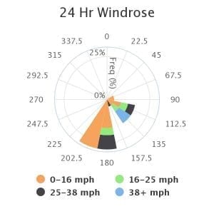
Winds averaged SE 11 mph, max 42 mph . Gusts averaged SE 11 mph, max gust SSE 56 mph.
Overnight at 4500′:
Temps averaged 18ºF overnight, with a Low of 16ºF.
Winds averaged SW 6 mph overnight. Max gust SSW 34 mph.
Marmot winds since 1/24:
NWS Rec Forecast HERE
NWS point forecast HERE
State Parks Snow Report and Motorized Access information HERE
Additional Information
TREND
The avalanche hazard, for wind slabs in particular, will remain the same through today and begin to improve tomorrow as the snowpack has a chance to adjust to new loads.
The NWS Hatcher Pass recreational weather forecast for today:
                Today        Tonight

Temp at 1000`      31 F         24 F

Temp at 3000`      21 F         26 F

Chance of precip   60%          20%

Precip amount
(above 1000 FT)    0.07 in      0.01 in

Snow amount
(above 1000 FT)    0-1 in       trace

Snow level         sea level    sea level

Wind 3000` ridges  SE 9-18 mph  SE 8-15 mph
Announcements
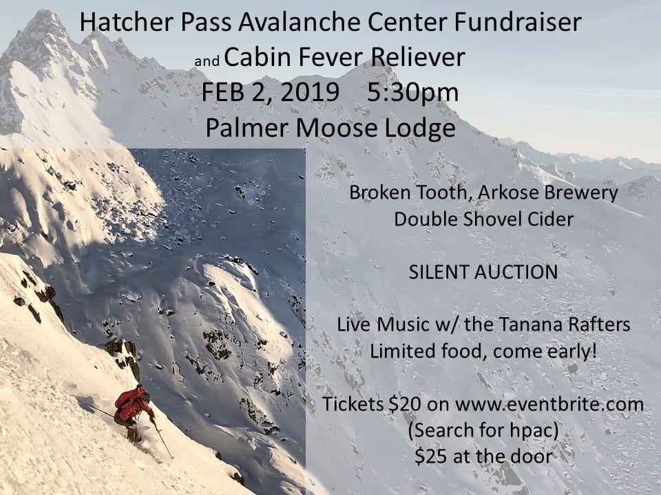
Save the date: HPAC Annual Fundraiser and Cabin Fever Reliever, Saturday,February 2, 2019 at the Moose Lodge in Palmer. Tickets available now for $20 HERE or cash only at Backcountry Bike and Ski and Active Soles in Palmer. $25 at the door.
BOTTOM LINE
Strong winds combined with 3-4″ of new snow since 1/24 have created a CONSIDERABLE avalanche hazard for newly formed wind slabs at upper elevations, on Northwest to Northeast aspects, on slopes 35° and steeper.
Avoid slopes with terrain traps, as any size avalanche may be able to carry or wash a person into terrain traps, significantly compounding the hazard.
New snow may conceal a generally shallow snowpack. Be cautious of shallowly buried hazards, such as rocks.
SUBMIT your OBSERVATIONS here!