Hatcher Pass
Above 3,500ft Moderate
2,500 to 3,500ft Moderate
Below 2,500ftLow
Degrees of Avalanche Danger
Additional Information
Archived advisories HERE.
Alerts
BOTTOM LINE
The avalanche hazard is MODERATE this morning and may rise to CONSIDERABLE this afternoon, depending on the amount of accumulated new snow and strength of the wind today.
A moderate hazard for human triggered avalanches 1-4 feet deep at mid to upper elevations exists. Avalanches will be possible to trigger this weekend and tricky to predict. REMOTELY triggered avalanches will be possible in some locations. Warning signs, such as whumphing and shooting cracks, may NOT be present.
AVOID STEEP SLOPES WITH TERRAIN TRAPS, and choose slopes with gentle, fanning runouts.
Moderate avalanche hazard does NOT equal safe conditions everywhere. Deciphering the avalanche puzzle will be challenging, with large (D2), human triggered avalanches possible on a multitude of weak layers in the snowpack for an avalanche to choose to fail on.
Announcements
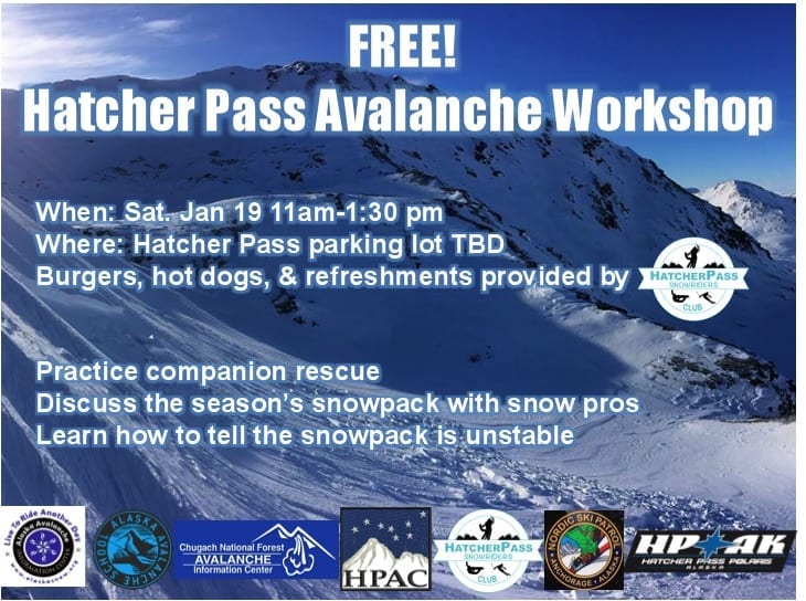
Mark your calendars for the annual Hatcher Pass Avalanche Workshop coming up on Saturday January 19th.