Cordova
Above 2,000ftModerate
1,000 to 2,000ftLow
Below 1,000ftLow
Degrees of Avalanche Danger
Weather
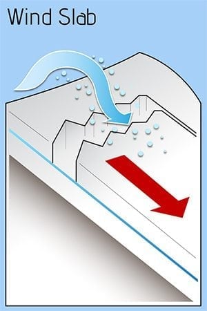
Rapid cold snow brought a couple inches of snow to sea level last Saturday night, precipitation became light Sunday as the freezing line rose above 1500 feet, 6 inches of snow fell Monday at sea level and above, and another 4 inches were added Tuesday evening. Since then, moderate to strong northerly wind has moved snow and the avalanche hazard towards southern slopes, though much of this moving snow is sublimating back into the atmosphere.
Expect northerly outflow winds to diminish tonight and clouds to build Friday night, as another low moves in. Models suggest 2 inches of water Saturday night into Monday and the freezing line fluctuating around sea level. This should translate into a foot of heavy snow at sea level and 2 feet in the upper mountains, with winds loading western aspects. The avalanche hazard may increase then.
