Cordova
Forecast Expired - 02/19/2019
Above 2,000ftHigh
1,000 to 2,000ftConsiderable
Below 1,000ftModerate
Degrees of Avalanche Danger
Avalanche Problems
Problem 1
Storm Snow:

Likelihood:
- Almost Certain
- Very Likely
- Likely
- Possible
- Unlikely
Size:
- Historic
- Very Large
- Large
- Small
Trend
- Increasing
- Steady
- Decreasing
Problem 2
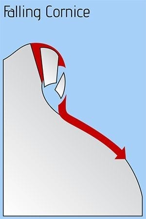
Falling Cornice:
Likelihood:
- Almost Certain
- Very Likely
- Likely
- Possible
- Unlikely
Size:
- Historic
- Very Large
- Large
- Small
Trend
- Increasing
- Steady
- Decreasing
Problem 3
Wind Slab:

Likelihood:
- Almost Certain
- Very Likely
- Likely
- Possible
- Unlikely
Size:
- Historic
- Very Large
- Large
- Small
Trend
- Increasing
- Steady
- Decreasing
Weather
We’ve received 2.5 inches of water in the last 36 hours. The freezing line has fluctuated between sea level and 1500 feet. This translates into 2 feet of heavy snow at tree line and above, with moderate to strong wind loading western aspects.
Expect precipitation to taper off after midnight. Mostly dry conditions Tuesday should allow the snow pack to begin adjusting, though caution should continue to be used on loaded western aspects. Also, northerly winds may create isolated wind slabs on southerly aspects. Wednesday looks to bring more precipitation, so the hazard may elevate again.