Haines Avalanche Center
Above 2,500ftModerate
1,500 to 2,500ftModerate
Below 1,500ftModerate
Degrees of Avalanche Danger
Avalanche Problems
Problem 1
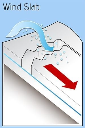
Mother nature has calmed down these past days. Cold and clear nights with no new load added to the pack has allowed time for healing. Older wind slabs may still be lingering in specific terrain, so be vigilant. Light outflow (North/North West) winds the last days may have formed newer wind slabs. The recent showers and last snow fall came in cold and is available for wind transport. Increasing winds Saturday and defiantly Sunday will increase the problem even more.
Likelihood:
- Almost Certain
- Very Likely
- Likely
- Possible
- Unlikely
Size:
- Historic
- Very Large
- Large
- Small
Trend
- Increasing
- Steady
- Decreasing
Problem 2
Dynamic weather causes dynamic problems. Persistent issues in the mid pack and at the base continue to exist. Likely rounded and bonding, but still needs respect. They are widespread in the 1,500 – 3,500′ (unknown in alpine region??) zones but stubborn to initiate. Which makes this problem unlikely. Keep in mind the snowpack is 4-6+’ deep in this zone which could cause some serious issues if slabs are released(step downs). Best practices would to avoid shallow/rocky areas, especially in complex terrain.
Likelihood:
- Almost Certain
- Very Likely
- Likely
- Possible
- Unlikely
Size:
- Historic
- Very Large
- Large
- Small
Trend
- Increasing
- Steady
- Decreasing
Avalanche Activity
Bottom Line: We are dealing with 2 critical situation….Natural disasters in our home town and a global pandemic. Other than that, we have limited data and observations to make a moderate to high confidant assessment of what is really going on out there. So as my dad always tells me, “be cool out there!”. It is still early and there is bigger things going on other than our desires to be rad or ride epic pow.
Weather
Mostly clear weather for the region the past two days saw daytime and overnight temperatures drop below freezing down to sea-level. Strong northerly outflow winds are forecasted through the weekend with light precipitation into early next week. Wind gust could be up to 45 mph with low temperatures 10-20F.
| Snow Depth [in] | Last 24-hr Snow/SWE [in] | Last 3-days Snow/SWE [in] | Today’s Freezing Level [ft] | Today’s Winds | Next 24-hr Snow/SWE | |
Mount Ripinsky @ treeline |
~90″ | 0″ / 0.00* | 0″ / 0.00* | Sea-level | Moderate to Strong, N | 0″ / 0.00* |
Flower Mountain @ treeline |
56″ | 0″ / 0.00* | 0″ / 0.00* | Sea-level | Moderate to Strong, N | 0″ / 0.00* |
Chilkat Pass @ 3,100ft |
13″ | 0″ / 0.00* | 0″ / 0.00* | Sea-level | Moderate to Strong, N | 0″ / 0.00* |
( *star means meteorological estimate )
Additional Information
It’s time to start thinking avalanche. Dust off your gear and make sure it is fully functional. Put new batteries in your beacons! Do a beacon practice to start the season and keep your skills fresh. If you head into the hills, watch out for avalanche conditions, and be especially careful of rocks and hidden hazards like crevasses beneath the snow. WEAR A HELMET!

Education Video Links:
- AIARE
- How to Practice Avalanche Rescue Snowmobile Edition: https://youtu.be/2ML499MMDfM
- AK Sled Shed Motorized Learning:
- Intro: https://youtu.be/aoagKHfGkxs
- Personal Electronics in Avalanche Terrain: https://youtu.be/2Vz9S0OEyFk
- Snowmobile Macgyver Tool Kit: https://youtu.be/4WBNu_t6Bbk
- Head and Face Protection: https://youtu.be/jIzW89wOyZI
- Pre-season prep: https://youtu.be/zJmrb8cZlR4
- My Transceiver: https://youtu.be/yblaDWP7Jf8
- BCA Avalanche Safety for Snowmobilers
- How to Fix Common Snowmobile Problems in the Field: https://youtu.be/g9fiTxEvuFk
- Sleducation: Avalanche Safety for Snowmobilers: https://youtu.be/EWFOd_9DYb8
- Intro to Avalanche Transceivers for Snowmobilers: https://youtu.be/6ZLSBmsceog
- Avalanche Transceiver Trailhead Test for Snowmobilers: https://youtu.be/rWoXbadFBsY
- Avalanche Transceiver Searching Use Snowmobiles: https://youtu.be/w1ucyI6LMXM
- BCA Avalanche Rescue Series
- Beacon Search 101: https://youtu.be/nnHXLVA2FcE
- Avalanche Probing 101: https://youtu.be/-0_yDN5Drzw
- Avalanche Shoveling 101: https://youtu.be/dGQg9o3vAkM
- Organizing a Backcountry Rescue: https://youtu.be/gywtmukgt8s
- Post Avalanche Patient Care: https://youtu.be/9FyIeUy4wpQ
- Backcountry Evacuation: https://youtu.be/WPF-dciefL8
- Complex Multiple Burials Backup Techniques: https://youtu.be/pB6AfY2KyYo
- National Avalanche Center
- Avalanche Problems Explained: https://youtu.be/DkbnT_9-cHU
- Intro to North American Avalanche Danger Scale: https://youtu.be/r_-KpOu7tbA
Announcements
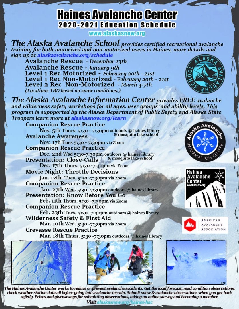
We have begun conditions updates for winter 2020/2021. Click the + Full Forecast link below for each zone to read more.

