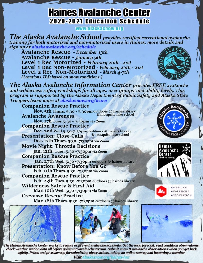
Haines Avalanche Center
Above 2,500ftModerate
1,500 to 2,500ftModerate
Below 1,500ftLow
Degrees of Avalanche Danger
Avalanche Problems
Problem 1
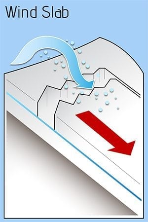
With winds increasing out of the north and snow in the forecast, wind slab hazard on specific terrain features is expected to increase in sensitivity to triggers. Human triggered avalanches remain possible. While the danger is mostly moderate for this problem, pockets of considerable do exist and will increase in likelihood of triggering, especially over any deep persistent weak layers. An increase in wind speed/direction could indicate elevated hazard and make human triggering more likely. Identify suspect leeward slopes and look for visible signs of wind loading. Strong over weak layering at the surface and a punchy feel tells you you’re on a slab. Be vigilant to any changing conditions, avoid run out zones, only expose one person at a time to the slope and stay away from run-out zones and terrain traps. Wind slabs range from predictable to unpredictable due to slab stiffness and spatial variability.
Likelihood:
- Almost Certain
- Very Likely
- Likely
- Possible
- Unlikely
Size:
- Historic
- Very Large
- Large
- Small
Trend
- Increasing
- Steady
- Decreasing
Problem 2
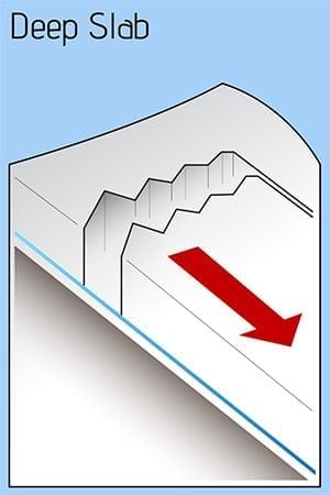
Persistent weak layer concerns since early December are now buried under the weight of the new snow, and are deep enough that the likelihood of triggering one of these deep slab avalanches is unlikely. Remember that shallow, or thin areas in the snowpack could be ripe for access to these deep instabilities, especially above treeline where the snowpack is generally thinner than mid-elevations. Travel where the snowpack is fat and make assessments where it is not. This will help save some time digging. Think about how upper layers over the terrain could communicate to layers further down in the snowpack. Minimize exposure, use terrain wisely, avoid excess time in run-out zones, practice safe travel technique and remember how your decisions effect yourself and others.
Likelihood:
- Almost Certain
- Very Likely
- Likely
- Possible
- Unlikely
Size:
- Historic
- Very Large
- Large
- Small
Trend
- Increasing
- Steady
- Decreasing
Avalanche Activity
Bottom Line: Wind slabs at and above treeline are an increasing hazard in each forecast zone as the north wind picks up and snow begins to fall. Widespread surface hoar crystals and near-surface facets currently at the snowpack’s surface began to grow after the 12/29 storm cleared out with two cold clear nights that followed. Moisture and fog from that event helped create a thin 1cm surface crust from 1,500′ – 3,000′. This pencil hard crust with surface hoar sits over the 3-5″ of softer deposits from Tuesday. Any future snow load, either wind deposits or snowfall that buries the surface hoar at the surface will create a persistent weak layer.
Good News: Before the new snow starts to fall, it is a great time to continue mapping the spatial distribution of surface hoar and make an observation to the HAC page. For the big picture, identify areas of shallow, underlying terrain could be rocks, cliffs, trees, vegetation, or un-supported slopes where it would be easiest to trigger deeper buried weak layers. Keep in your decision making framework, the drawn out global pandemic response and taxed EMS resources. Use informal slopes tests, such as getting off the track, digging hasty pits, probing for strong over weak layering beneath you, and using low-consequence test slopes to help identify the avalanche problem.
Weather
Between 3-5″ of snow fell throughout the forecast zones earlier this week, as temperatures increased Tuesday before dropping quickly Wednesday. Latent moisture from the 12/29 storm produced areas of patchy fog closer to sea-level, while further up valley the night sky stayed clear, with cold overnight temperatures. Increasing clouds and snowfall is expected for the region heading towards the weekend.
| Snow Depth [in] | Last 24-hr Snow/SWE [in] | Last 3-days Snow/SWE [in] | Today’s Freezing Level [ft] | Today’s Winds | Next 24-hr Snow/SWE | |
| Mount Ripinsky @ treeline | 110″ | 0″ / 0.00 | 0″ / 0.00 | 0′ | Moderate, N | 2″ / 0.20* |
| Flower Mountain @ treeline | 65″ | 0″ / 0.00 | 0″ / 0.00 | 0′ | Moderate, NW | 1″ / 0.10* |
| Chilkat Pass @ 3,100ft | 38″ | 0″ / 0.00 | 0″ / 0.50 | 0′ | Moderate, NW | 1″ / 0.01* |
( *star means meteorological estimate )
Additional Information
Practice like you play. Dust off your gear and make sure it is fully functional. Put new batteries in your beacons! Make sure everyone in the group has a functioning beacon, shovel and probe – and knows how to use them, keep your skills fresh. If you head into the hills, watch out for avalanche conditions, and be especially careful of rocks and hidden hazards like crevasses beneath the snow. WEAR A HELMET!

Education Video Links:
- AIARE
- How to Practice Avalanche Rescue Snowmobile Edition: https://youtu.be/2ML499MMDfM
- AK Sled Shed Motorized Learning:
- Intro: https://youtu.be/aoagKHfGkxs
- Personal Electronics in Avalanche Terrain: https://youtu.be/2Vz9S0OEyFk
- Snowmobile Macgyver Tool Kit: https://youtu.be/4WBNu_t6Bbk
- Head and Face Protection: https://youtu.be/jIzW89wOyZI
- Pre-season prep: https://youtu.be/zJmrb8cZlR4
- My Transceiver: https://youtu.be/yblaDWP7Jf8
- BCA Avalanche Safety for Snowmobilers
- How to Fix Common Snowmobile Problems in the Field: https://youtu.be/g9fiTxEvuFk
- Sleducation: Avalanche Safety for Snowmobilers: https://youtu.be/EWFOd_9DYb8
- Intro to Avalanche Transceivers for Snowmobilers: https://youtu.be/6ZLSBmsceog
- Avalanche Transceiver Trailhead Test for Snowmobilers: https://youtu.be/rWoXbadFBsY
- Avalanche Transceiver Searching Use Snowmobiles: https://youtu.be/w1ucyI6LMXM
- BCA Avalanche Rescue Series
- Beacon Search 101: https://youtu.be/nnHXLVA2FcE
- Avalanche Probing 101: https://youtu.be/-0_yDN5Drzw
- Avalanche Shoveling 101: https://youtu.be/dGQg9o3vAkM
- Organizing a Backcountry Rescue: https://youtu.be/gywtmukgt8s
- Post Avalanche Patient Care: https://youtu.be/9FyIeUy4wpQ
- Backcountry Evacuation: https://youtu.be/WPF-dciefL8
- Complex Multiple Burials Backup Techniques: https://youtu.be/pB6AfY2KyYo
- National Avalanche Center
- Avalanche Problems Explained: https://youtu.be/DkbnT_9-cHU
- Intro to North American Avalanche Danger Scale: https://youtu.be/r_-KpOu7tbA
Announcements
Click the + Full Forecast link below for each zone to read more. Submit observations. Win prizes. Each snow, weather & avalanche observation outside of the HAC staff will be entered in a raffle drawing. The more observations, the more chances to win!

