Haines Avalanche Center
Above 2,500ftLow
1,500 to 2,500ftLow
Below 1,500ftLow
Degrees of Avalanche Danger
Avalanche Problems
Problem 1
The Bottom Line: In the Lutak zone specifically, heavy rain last week has solidly refrozen in the upper snowpack and increased stability. But, the most recent crust has created a near perfect weak layer. With a new load of snow in the forecast, add a trigger and it could be a perfect recipe for an avalanche, with step down potential. Keep this in mind going into next week.
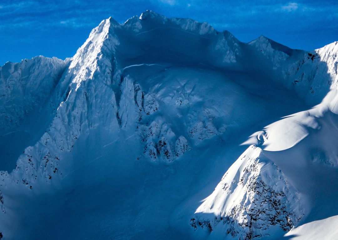
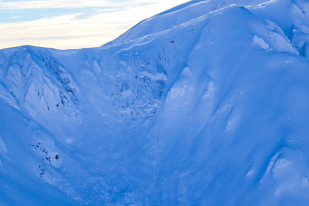
Despite todays low danger, you should still exercise caution, space your group out, and only expose one person at a time to slopes 30 degrees and steeper. Avoid thin areas above 3000ft where there may be lingering depth hoar at the ground. Also, avoid steep gullies/couloirs/cliffy areas that may contain lingering pockets of deep slab instability and could still possibly lead to a deep, deadly avalanche.

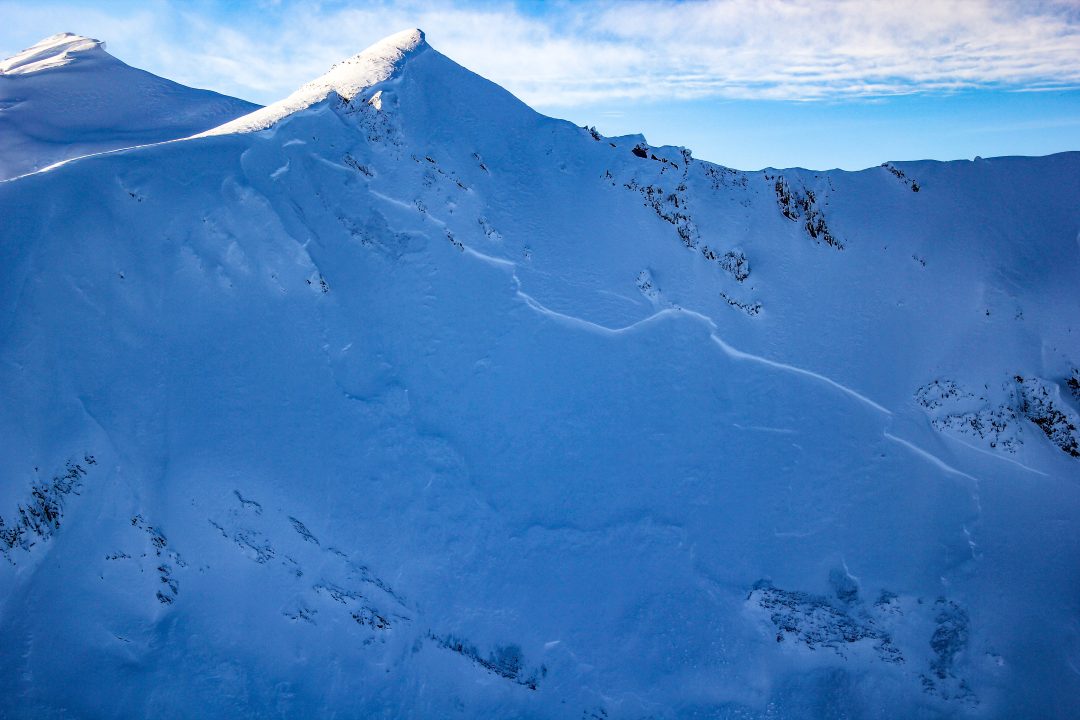
Surface Hoar observed in sheltered N-NE areas of Lutak Feb 1.
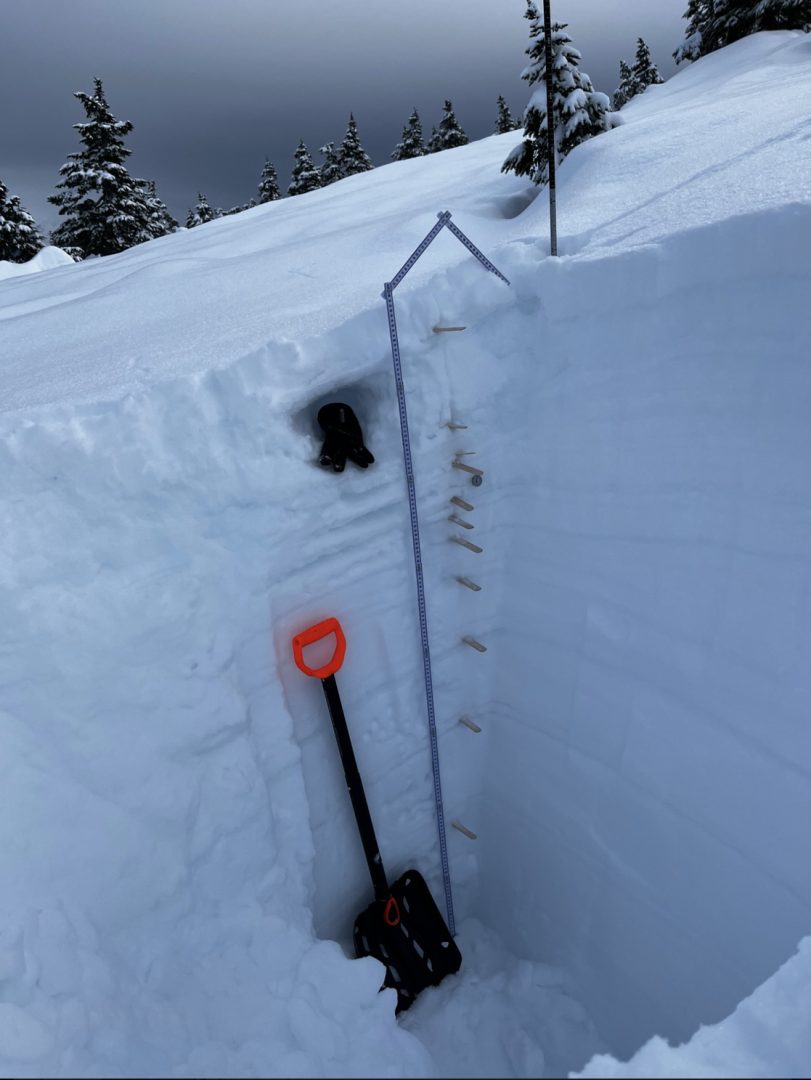
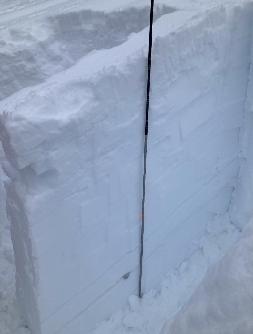
Pit from Feb 1 in Lutak reveals a layer cake of a snowpack.
Lutak, Feb 4 PST 70/130 End down 130 rounding faceted polycrystals.
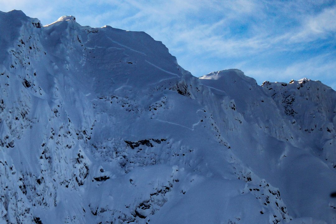
An unlikely to trigger, but high consequence deep slab layer.

Likelihood:
- Almost Certain
- Very Likely
- Likely
- Possible
- Unlikely
Size:
- Historic
- Very Large
- Large
- Small
Trend
- Increasing
- Steady
- Decreasing
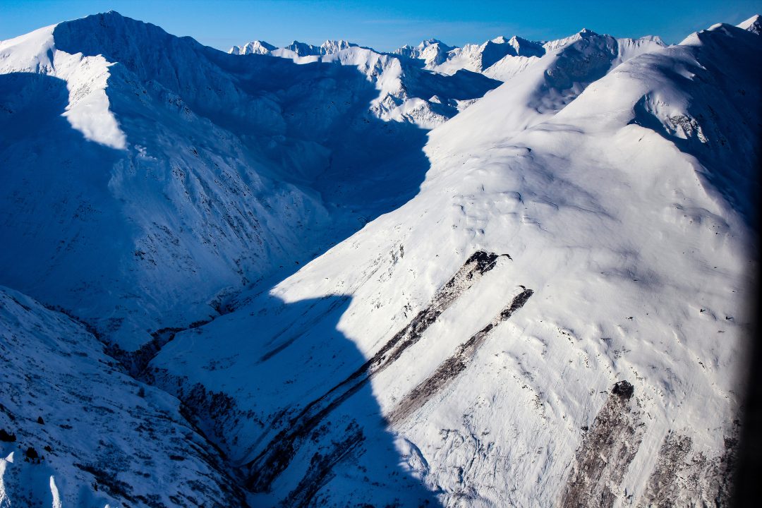
Avalanche Activity
Lutak Zone:
Jan 28:
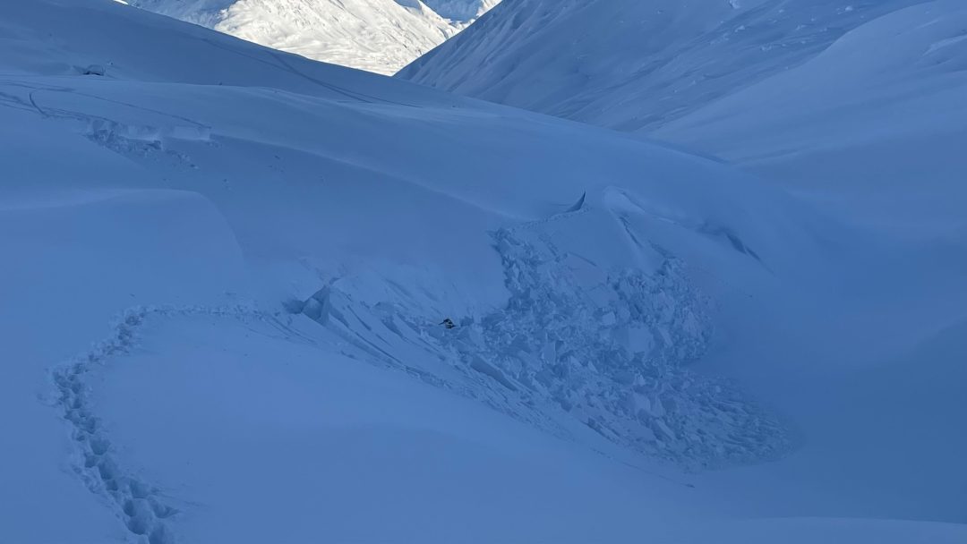
Glory Hole NW-aspect around 3,200′
Transitional and Chilkat Pass Zones:
January 25-29th:
Isolated fresh D2 wind slab avalanches in cross-loaded gullies near the Little Jarvis/Klehini area.

Reports of two snowmachine-triggered slides at the Pass, one was this D2 up West Nadahini Creek above 4,000′ failed 2-7′ deep on an isolated terrain feature. (likely slid on buried surface hoar)
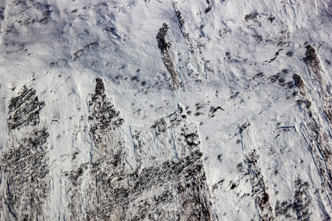
Recent Natural activity
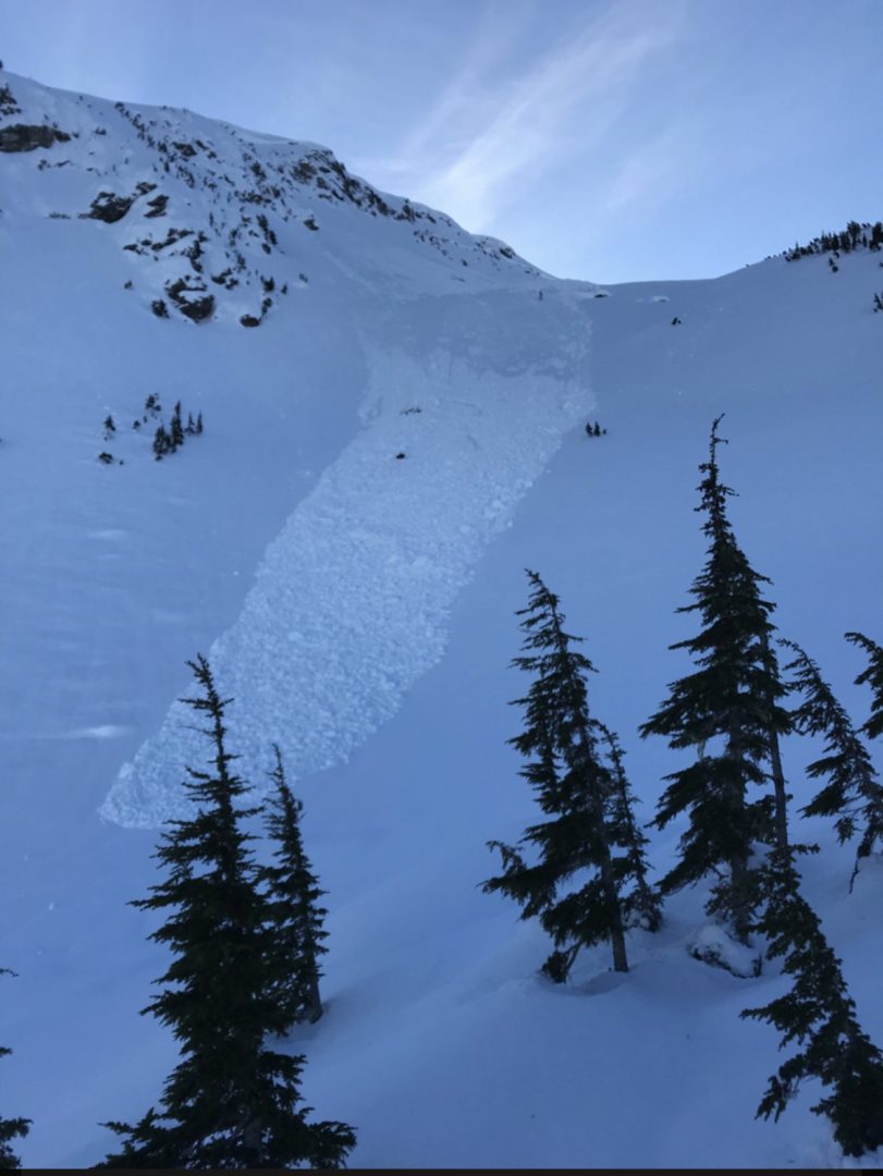
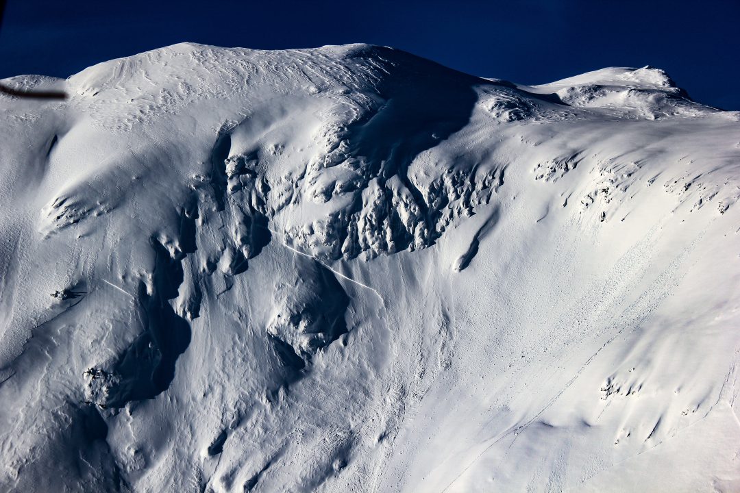
R4D2.5 at the Pass, likely ran on buried surface Hoar, stepped down to depth hoar at ground. Photo by David Morisette, via MIN.
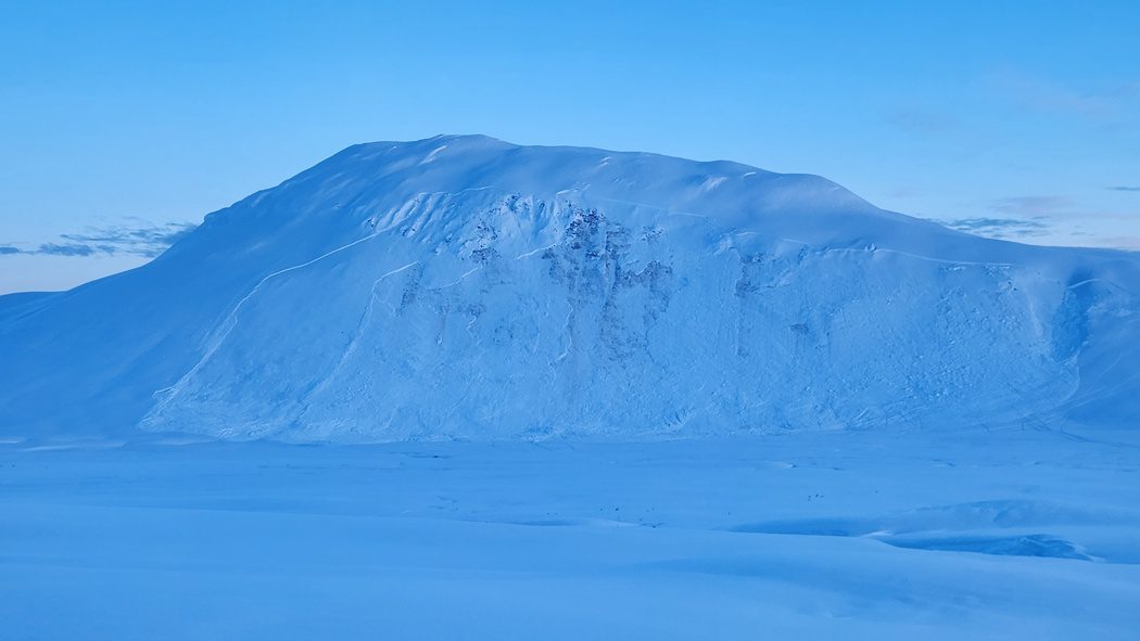
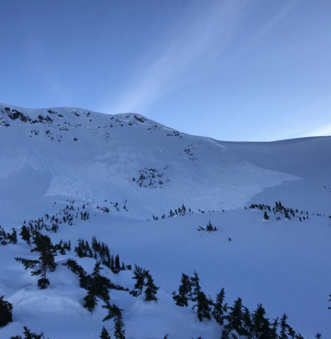
D3 NE aspect 6000′ near Nadahini with widespread propagation.
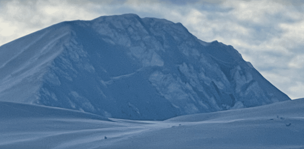
D3 cycle between 3000-6000ft. All aspects. Most were unsupported slopes or rocky areas. Crowns 1-3m deep, ran just above ground.
Multiple D2 that ran about 2ft deep. In wind protected areas.
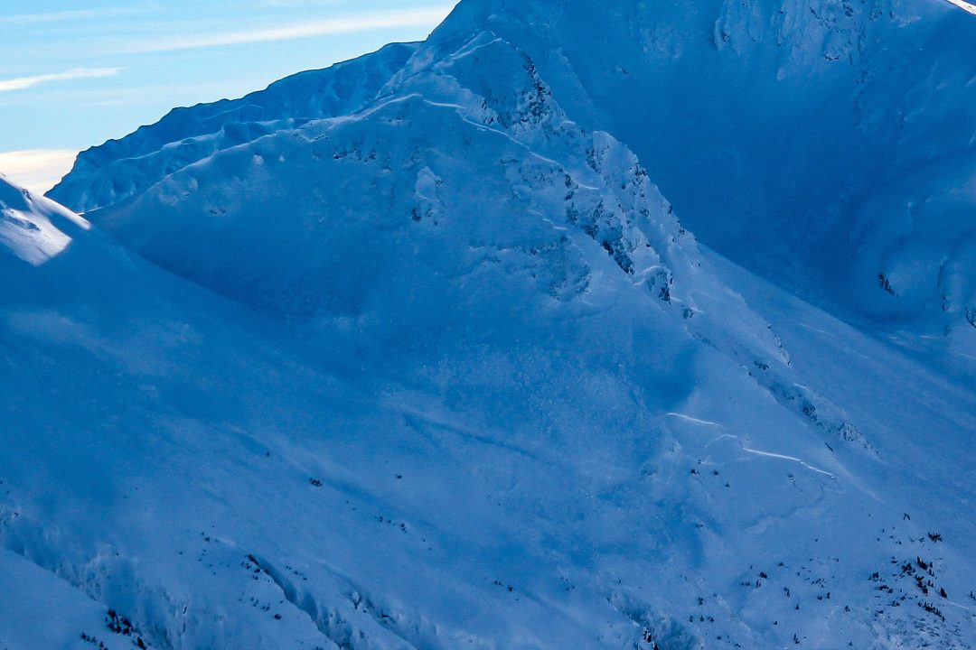
2000-3000ft widespread full depth wet slabs and glide avys, all aspects.
D2 N aspect 4300ft sub bowl of Old Faithful failed down to near ground, Was confined to a smaller pocket.
D3 on SW aspect at Lutak Inlet, ran down to the water
D4 on Takhin Ridge
Weather
Forecast:
Overcast. Light N winds switch to SE and build to moderate with strong gusts by the evening. Snow fall expected Sunday night into Monday, possible accumulation 6-9 inches. Temperatures increasing from low to high 20s.
Recent Weather Summary:
- Jan 17-26 brought around 5″ of precip (3-5feet of new snow above 3000ft), strong SE winds, and a noticeable warmup
- Surface Hoar and Near Surface Facet growth Jan 8-10
- A strong front brought 24-30″ of snow above 2000ft on Jan 2nd.
- There was widespread Surface Hoar growth on Dec 31st.
- Dec 23-26 brought 10-18″ of new snow and a sharp rise in temperatures from -10F to 30F along with variable winds
- Dec 16-23 brought strong NW winds and arctic cold temperatures
- Dec 15 brought warmth/light rain up to 2600ft
- Complete Season Histories: Transitional Zone Lutak Zone
| Snow Depth | Last 24-hr Snow/SWE | Last 3-days Snow/SWE | Today’s Freezing Level | Today’s Winds | Next 24-hr Snow/SWE | |
| Mount Ripinsky @ 2,500′ | 92″ | 0″ / 0.00″ | 3″ / 0.25″ | 0′ | SE, light increasing to mod | 9″ / 0.90″ |
| Flower Mountain @ 2,500′ | 49″ | 0.50″ / 0.02″ | 3″ / 0.20″ | 0′ | SE, light increasing to mod | 7″ / 0.70″ |
| Chilkat Pass @ 3,100ft | 40″ | .00″ / 0.00″ | 1″ / 0.08″ | 0′ | SE, light increasing to mod | 3.6″ / 0.30″ |
Additional Information
WEAR A HELMET! Be careful of rocks and hidden hazards. Be prepared for crevasses when on a glacier.
Are your riding companions trained and practiced in avalanche rescue? Everyone in your group needs to have a beacon, shovel, and probe, and know how to use them. Our mountains have very limited cell coverage, carry an emergency communication device and enough gear to spend the night.

Avalanche Canada’s Daily Process Flow – Utilize this every day you go out in the mountains.
Announcements
Click the +Full Forecast link below for each zone to read more. If you see any recent natural avalanche activity, or signs of instability please submit an observation.