Haines Avalanche Center
Above 2,500ftHigh
1,500 to 2,500ftHigh
Below 1,500ftHigh
Degrees of Avalanche Danger
Avalanche Problems
Problem 1
The Bottom Line: We are finally getting heavy precipitation and warmth, which will likely cause a natural avalanche cycle today. Some of these slides could be very large, step down to the ground, and run full path to hit lower runout zones in the valley bottoms. Avoid all avalanche terrain and runout zones today. If you venture out, stick to forested areas and be careful to avoid any steep openings or gullies/terrain traps.
Below 2000ft on all aspects, we have had plenty of rain to saturate the upper snowpack layers and cause natural wet slabs and large point releases. Wet slides continue to be likely today in these middle-elevation areas. Stay away from terrain traps and slopes 30-degrees and steeper.
Any avalanches coming down from the Alpine may entrain large amounts of wet snow and continue full-path down to lower runout zones.

Likelihood:
- Almost Certain
- Very Likely
- Likely
- Possible
- Unlikely
Size:
- Historic
- Very Large
- Large
- Small
Trend
- Increasing
- Steady
- Decreasing
Problem 2
Above 2000ft: The Lutak zone has received 15″ of new snow already, with up to 18″ more coming today through Saturday. Needless to say, this is plenty to move around in steep terrain. Wind affected areas will be slabby and tender with natural and human-triggered avalanches likely. The new/old snow interface about 2ft deep consists of crust/facet combo layers that were noticeably weak recently.

Likelihood:
- Almost Certain
- Very Likely
- Likely
- Possible
- Unlikely
Size:
- Historic
- Very Large
- Large
- Small
Trend
- Increasing
- Steady
- Decreasing
Problem 3
We should remain aware that very deep and wide destructive avalanches need to be considered and planned for accordingly. Pay attention to run-out paths and leave wide margins of safety for larger than expected slides. Terrain management is critical.
Smaller avalanches in the upper snowpack or cornice failures could step down, leading to a massive avalanche.
Old Melt Layers and Crusts:
- A buried persistent weak layer about 6 feet deep (The “Big Warmup” Layer, Formed Nov 17th) is still a concern.
- It is a thick refrozen crust with weak faceted snow above. This is an unusual and unpredictable weak layer because it formed during a thaw event and then re-froze while cold temperatures faceted the stout crystals.
- A wide safety margin is necessary. This setup could produce avalanches that break wider than expected, and are most likely to be triggered from shallow trigger points like rocks or small trees. You could ride the same slope numerous times until that right spot produces a large destructive slide.
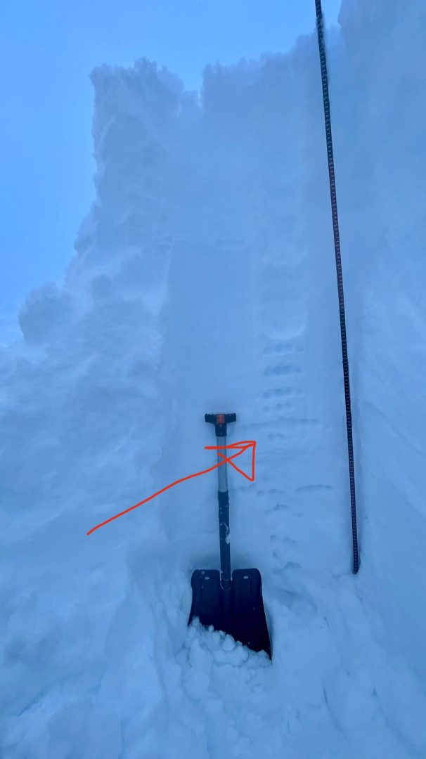
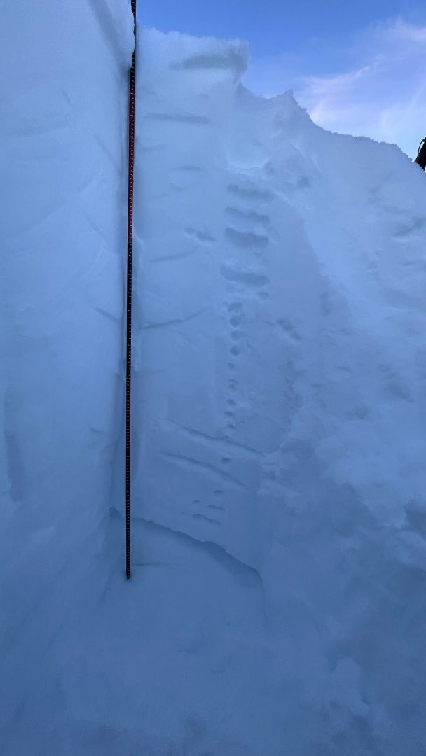
Photos of the “Big Warmup” facet layer in the Transitional Zone at 2500ft on 1/2 with test results ECTP18 that demonstrated propagation potential on this layer. And a photo from Old Faithful on 1/12 of a 5″ thick layer of facets down 170cm.
Observations in all zones throughout December and now into January have found moderate strength and quick propagation on failures within the “Big Warmup” crust/facet layer. We know it to exist at all elevations above 1000ft — even up to the highest summits. We expect this layer (and other midpack crust-facet layers) to be an ongoing issue going forward.
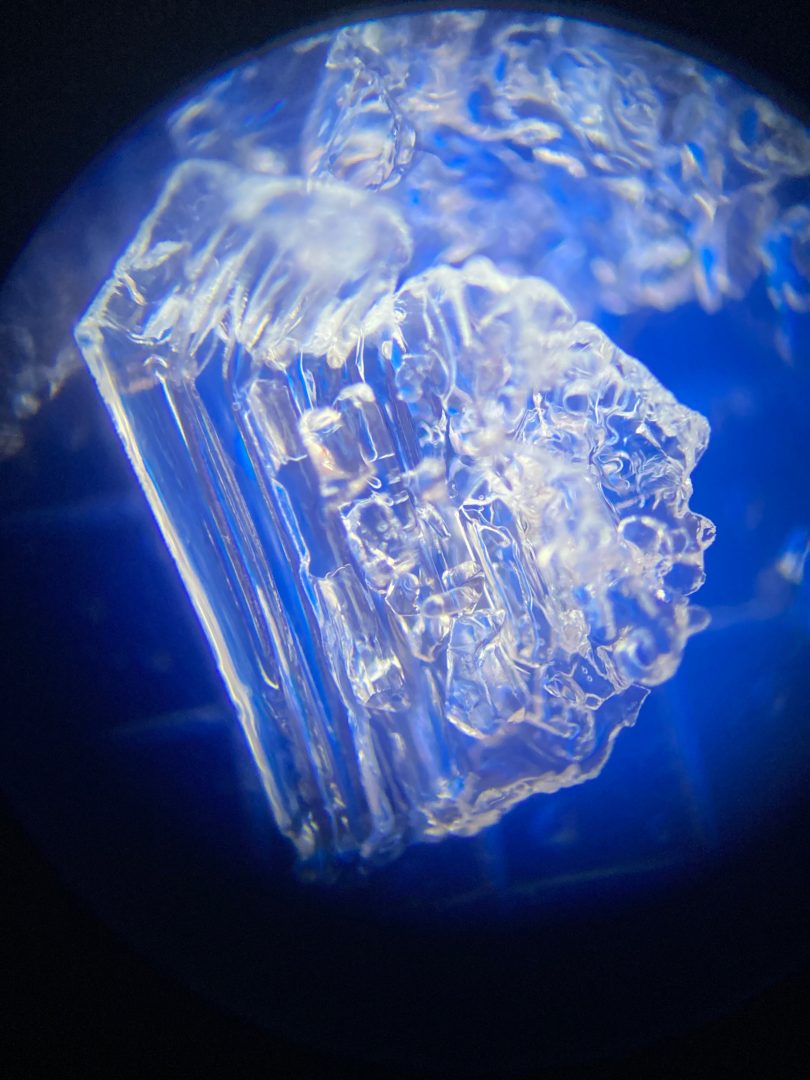
Depth Hoar at the Ground (Above 3,000′):
- October snow followed by long cold snaps created depth hoar at the ground in most areas. These angular snow grains are well developed into a weak layer that behaves like brittle glass.
- As the snow gets deeper, the load over this layer increases, and it could collapse. You are most likely to human-trigger this layer from shallow spots around rocks, or trees, or have a surface avalanche step down to the ground on this layer. Any slides that break to the ground are likely to be deadly.
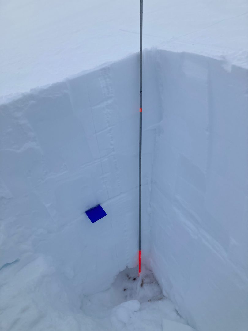
Photos shows 6-9mm advanced depth hoar at the ground down 180cm with ECTP 25 down 80cm on facets below a crust in the Haines Pass Zone at 4,000ft on a NE-aspect.

Likelihood:
- Almost Certain
- Very Likely
- Likely
- Possible
- Unlikely
Size:
- Historic
- Very Large
- Large
- Small
Trend
- Increasing
- Steady
- Decreasing
Avalanche Activity
Over the last 2 weeks:
In the Haines Pass, D2 N aspect ~5000ft natural slide, cornice fell and triggered slide- looked recent, failed mid second week of January. D1 W aspect ~5500ft, piece of cornice fell and triggered small slide/ sluff, potentially remotely triggered by a group.
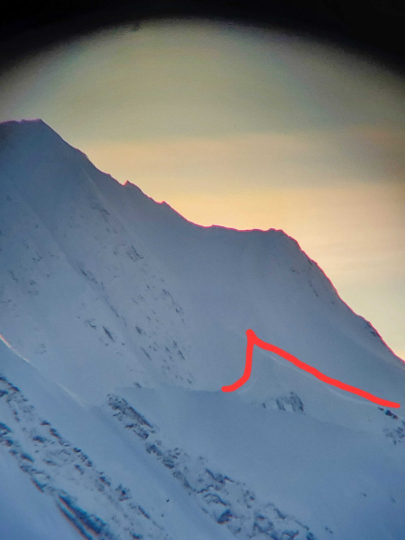
A few natural deep slabs ran during a short period of warm weather in the Lutak zone. These isolated slides were D3+ sized, running 3-9ft deep and stepped down to the ground in spots. The largest ran on an unsupported slope above cliffs. Takhin ridge (E aspect around 3000ft) had several D2-D3 natural avalanches observed that ran about 2ft deep with very wide and complete propagation. This was in a protected basin where Surface Hoar likely grew before the last storm.
Weather
Forecast:
Expect heavy precipitation Friday with Snow levels between 1500-2000ft, and light winds becoming moderate SE. Light – Moderate precipitation continues Saturday, with snow levels dropping back to sea level. Overall we are expecting 2-day total precip. of around 2.5″, which would add up to 30″ of new snow above the snowline in the Lutak zone, decreasing as you go inland towards the Transitional and Pass zones.
Recent Weather Summary:
- Heavy snow and rising snow levels came in Jan 19
- Surface Hoar and Near Surface Facet growth Jan 8-10
- A strong front brought 24-30″ of snow above 2000ft on Jan 2nd.
- There was widespread Surface Hoar growth on Dec 31st.
- Dec 23-26 brought 10-18″ of new snow and a sharp rise in temperatures from -10F to 30F along with variable winds
- Dec 16-23 brought strong NW winds and arctic cold temperatures
- Dec 15 brought warmth/light rain up to 2600ft
- Complete Season Histories: Transitional Zone Lutak Zone
| Snow Depth | Last 24-hr Snow/SWE | Last 3-days Snow/SWE | Today’s Freezing Level | Today’s Winds | Next 24-hr Snow/SWE | |
| Mount Ripinsky @ 2,500′ | 99″ | 11″ / 1.00″ | 15″ / 1.30″ | 2500′ | light, var | 18″ / 1.50″ |
| Flower Mountain @ 2,500′ | 59″ | 4″ / 0.40″ | 9″ / 0.80″ | 1500′ | light, var | 12″ / 1.00″ |
| Chilkat Pass @ 3,100ft | 40″ | 4″ / 0.30″ | 8″ / 0.70″ | 1500′ | light, var | 9″ / 0.80″ |
Additional Information
WEAR A HELMET! Be careful of rocks and hidden hazards. Be prepared for crevasses when on a glacier.
Are your riding companions trained and practiced in avalanche rescue? Everyone in your group needs to have a beacon, shovel, and probe, and know how to use them. Our mountains have very limited cell coverage, carry an emergency communication device and enough gear to spend the night.
Alerts
We are expecting a natural avalanche cycle today. Avoid all avalanche terrain and lower runout zones. Click the +Full Forecast link below for each zone to read more. Please submit your observations.