Hatcher Pass
Above 3,500ft Moderate
2,500 to 3,500ft Moderate
Below 2,500ftLow
Degrees of Avalanche Danger
Avalanche Activity
Numerous natural slab avalanches were observed this week, likely occurring 1/25 to 1/28, 1-2′ deep, up to D2 in size, failing on new snow/old snow interface, West > North > East, in elevations band 4,000′ to 4800′. See observation and PICS here.
Numerous natural dry loose sluffs were observed this week with 7-9.5″ of new, low density snow, the majority of which accumulated on 1/28, on all aspects, on slopes above 40º. Many of the loose dry avalanches occurred during the 1/28 storm, with more natural activity on 1/31 with the first direct solar gain on the new snow.
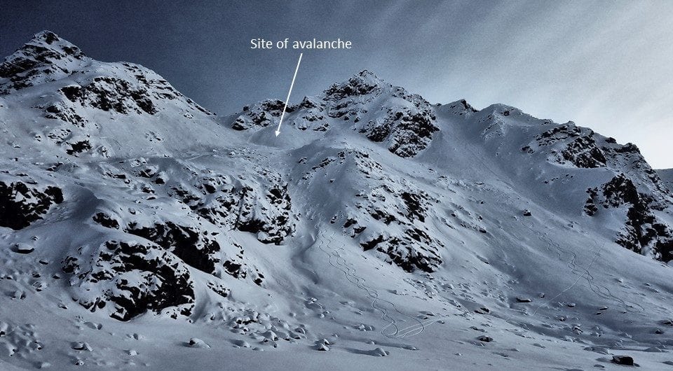
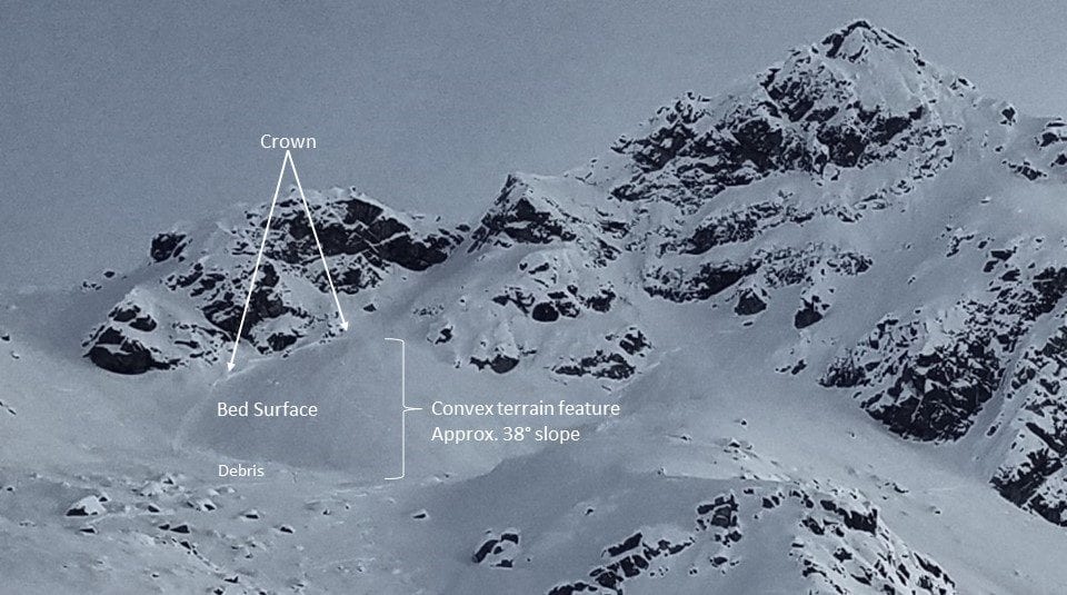
Yesterday, 2/1 – On the northern side of Friendship pass near Dog Sled Pass, a human triggered slab avalanche was reported on a NW aspect, 35-38º slope, 4700′, D1.5. One person was caught and carried, partially buried to their chest, no injuries. 2 pictures below.
Weather
This week’s weather at 3550′:
Temps averaged 25ºF, with a low of 17ºF and a high of 23ºF.
7-9.5″ of new snow accumulated this week.
Overnight at 3550′:
Temps averaged 14°F.
No new snow.
This week’s weather at 4500′:
Temps averaged 22ºF, with a low of 12ºF and a high of 27ºF.
Winds averaged SE 6 mph, max 13 mph . Gusts averaged SE 10 mph, max gust SE 23 mph.
Overnight at 4500′:
Temps averaged 11ºF overnight, with a Low of 10ºF.
Winds averaged SSE 4 mph overnight. Max gust S 19 mph.
NWS Rec Forecast HERE
NWS point forecast HERE
State Parks Snow Report and Motorized Access information HERE
Additional Information
TREND
A weather pattern change is forecasted for Sunday through Monday. Southwest flow is expected to bring new snow, with preliminary estimates at 15″. Models are showing winds 20-30 mph at 5000’. Additionally, surface hoar is currently widespread, 2-4mm in size. New snow and wind will increase the avalanche hazard.
NWS recreations forecast
The Hatcher Pass Mountain Forecast covers the mountains in the
Hatcher Pass Recreation Area.

This forecast is for use in snow safety activities and emergency
management.

                   Today        Tonight

Temp at 1000`      15 F         12 F

Temp at 3000`      17 F         19 F

Chance of precip   0%           50%

Precip amount
(above 1000 FT)    0.00 in      0.07 in

Snow amount
(above 1000 FT)    0 in         0-2 in

Snow level         sea level    sea level

Wind 3000` ridges  LGT/VAR      SE 0-7 mph

Remarks...Broad and moist southwesterly flow sets up early Sunday
morning and continues through Sunday night. A rough 24 hr(Sunday
morning through Sunday night) snowfall estimate of 15 inches is
possible in the higher elevations toward the mine.
Announcements
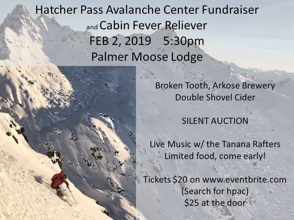
TONIGHT !! HPAC Annual Fundraiser and Cabin Fever Reliever, Saturday,February 2, 2019 at the Moose Lodge in Palmer. Tickets available now for $20 HERE or cash only at Backcountry Bike and Ski and Active Soles in Palmer. $25 at the door.
BOTTOM LINE
A MODERATE avalanche hazard exists for persistent slab and loose dry avalanches at mid to upper elevations. Human triggered avalanches are possible and natural avalanches are unlikely. A LOW hazard exists at low elevation.
Slab avalanches may be triggered on a variety of aspects, at mid to upper elevations, 1-2 feet deep, on slopes 35° and steeper and may be larger enough to bury, injure or kill. Shooting cracks and whumphing are bulls-eye clues for this avalanche danger.
Loose dry avalanches may be fast moving and large enough to sweep you off your feet, carrying you into secondary, compounding hazards. It will be possible to human trigger, and may be naturally triggered by direct solar radiation on southerly aspects, especially near rocks, on slopes 40° and steeper.
Choose slopes lacking terrain traps.
SUBMIT your OBSERVATIONS here!